

How-to
How to put a flag inside a country on a map (no After Effects)
To put a flag inside a country on a map, add the country’s boundary, then fill it with the flag image or clip the flag to the shape with a matte. Keep the shape and the flag on the same clip times, then frame the camera. In Maptake this takes a few layers in the browser, with no plugin.
What is the flag-inside-a-country effect?
Each country on the map is filled with its own flag. It tells the viewer who is who in two seconds, with no legend, which is why short videos about borders start with it: “This is Egypt. And this is Sudan.” The flags go in on the spoken words, then the camera leaves the big picture and drops onto the one place the story is about.
The video above does it: Egypt and Sudan fill with their flags, then the camera falls onto Bir Tawil, a 2,060 km² strip of desert that neither country claims. On our YouTube channel this Short had about 2,000 views and 65% of viewers stayed to watch, in YouTube Studio on 21 November 2026. The same recipe is behind the six other Shorts below.
Which way should I put the flag in the country?
There are two ways, and both use ordinary layers you can change later. The quick way is a setting on the shape. The matte way takes a few more steps and gives you control of the flag itself.
| Way | Use it when | Where to set it |
|---|---|---|
| Image fill on the shape | You want the flag in a country quickly, and the flag can simply fill the shape. | Add the boundary. In “Feature style”, under Area, choose “Image”, pick the flag, and set “Fit” to “Fill the shape”. |
| Flag image clipped by a matte | You want to place and size the flag yourself, swap flags on one shape, or zoom in close without the flag turning into one stripe. | Add the boundary as a white shape and an Image layer with the flag. On the image, open “Matte”, choose the shape as “Layer” and set “Mode” to “Alpha”. |
How do I do it step by step?
These are the steps in the editor, from the flag file to the MP4. Steps 3 and 4 are the two ways in the table above: do one of them.
- Download a PNG of the flag, for example from Wikimedia Commons, wide enough for the zoom you plan (1,200 px across is plenty for a country). Each file page states its licence.
- Type the country in the search bar (“Search places, regions, countries or coordinates…”), open the result and choose “Boundary” (“Add the boundary as a feature”). For a place the built-in data lacks, such as a small island, use “Feature”, then “Import a file”, with a GeoJSON outline.
- Select the new Feature layer, open “Feature style”, and under Area choose “Image”. Pick the flag with “Choose image” (or “Upload from computer”) and set “Fit” to “Fill the shape”.
- Set the shape’s “Fill” to white and its stroke to none. In the Add dock choose “Image” (“Image or video pinned to the map”), upload the flag and drag its corners until it covers the country (hold Ctrl or ⌘ while dragging a corner to stretch it freely). On the image layer open “Matte”, set “Layer” to the white shape and “Mode” to “Alpha”, and turn on “Hide matte layer”.
- On the timeline, make the shape’s clip start and end exactly when the flag’s clip does. If the shape outlasts the flag, the land shows as a white shape. To show the flag again later, add a clip on both layers at the same time.
- Add a Camera shot that holds both countries at the start, then a second shot that drops onto the odd piece of border. Use an easing curve on the move between them.
- In the Add dock choose “Audio” (“Music, voiceover, SFX”) and place one clip per spoken line. Use one voice for the story and a second, deeper voice for the name of the place and the closing line. Turn off “Fade” on the voice clips so the end of each line stays as loud as the start, and raise the deep voice’s “Volume” a little if it sounds quieter.
- Open “Export video” and choose “One video” for an MP4.
What goes wrong, and how do I fix it?
- The land turns white. The white matte shape is only hidden while the flag clip plays. Give the shape exactly the same clip times as the flag.
- The flag turns into one stripe when the camera zooms in. A flag as big as a country fills the screen with a single colour once you are close. Split the flag’s clip and give the later part a small flag that fits the view, or move the flag’s corners as the camera zooms in. The Llívia video shows a small flag inside a big one.
- The last word of a line is quiet. Voice clips come with a fade. Turn “Fade” off on them.
- Text on top of a flag is hard to read. Use white text with a dark outline, or the accent colour of the look.
- A disputed place gets a flag. Fill it with a neutral grey hatch instead, and word each side’s position as that side’s position.
How do I get the camera and the voices right?
Hold both countries for the first two seconds, with the first flag going in on the first sentence, then drop onto the odd place with a slam or a dive and put its name on screen as one big label. Close by pulling back to both countries, with the flags back on them, so the video ends where it began.
The narration is two voices. A narrator tells the story, and a second, deeper voice says only the name of the place and the last line. Our Shorts use AI voices; say so in the description.
For other camera moves, see how to highlight a country on a map, which covers fill, outline, glow and draw-on for the same shape.
Can an AI build it?
The Shorts below were built by an AI model that was connected to the Maptake editor over MCP, from a script in which every fact has a named source. It wrote the lines, added the shapes, flags, mattes, camera shots and voice clips, and checked the frames. Each result is an ordinary project, so you can open it and change a flag, a line or a camera shot by hand. To connect your own AI, see use Maptake from your AI.
Flag Shorts made in Maptake
Each of these has its own page with the narration, the sources and a project you can open as an editable copy.
-
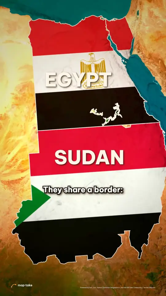 Bir Tawil, the land no country wants Borders · 9:16 · 49 s Egypt and Sudan, each filled with its flag, then the 2,060 km² nobody claims.
-
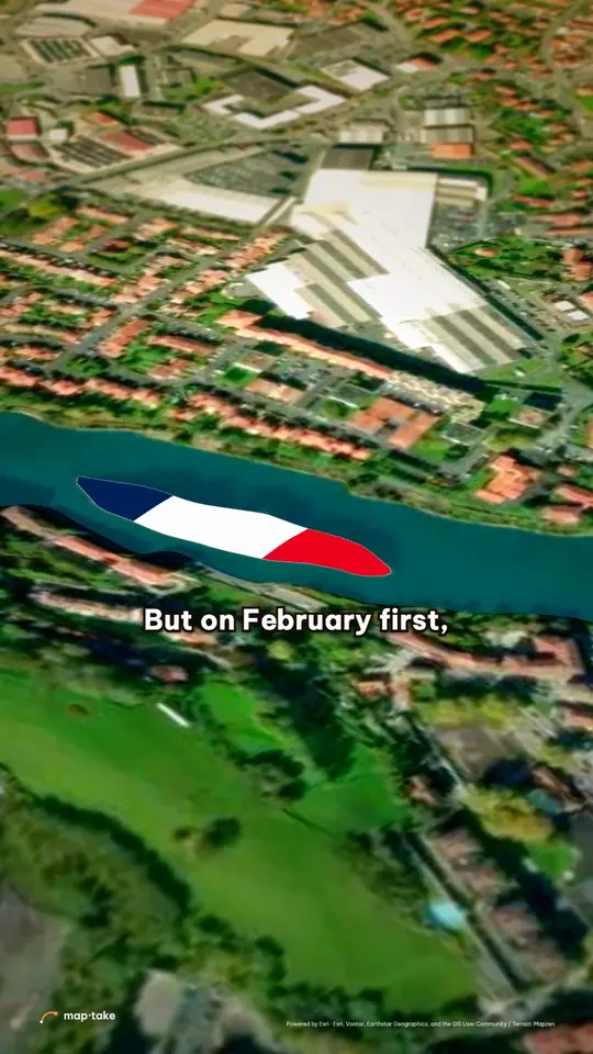 Pheasant Island, which changes country twice a year Borders · 9:16 · 36 s A 200 m river island that is French for six months and Spanish for six.
-
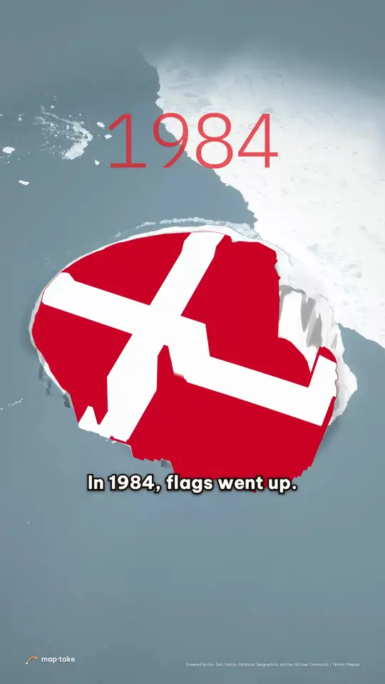 Hans Island and the Whisky War Borders · 9:16 · 38 s One island cut by the 2022 border into a Canadian half and a Danish half.
-
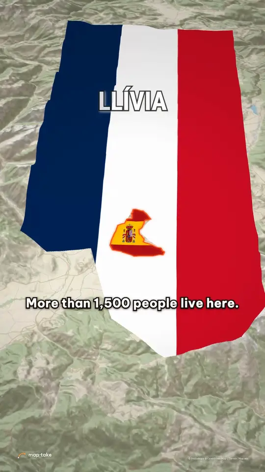 Llívia, the Spanish town inside France Borders · 9:16 · 33 s A small Spanish flag inside a big French one, with one road across the corridor.
-
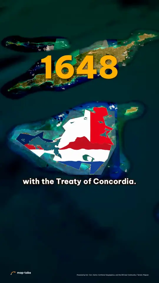 Saint Martin, one island with two countries Borders · 9:16 · 31 s A French flag on the north half and a Dutch flag on the south half.
-
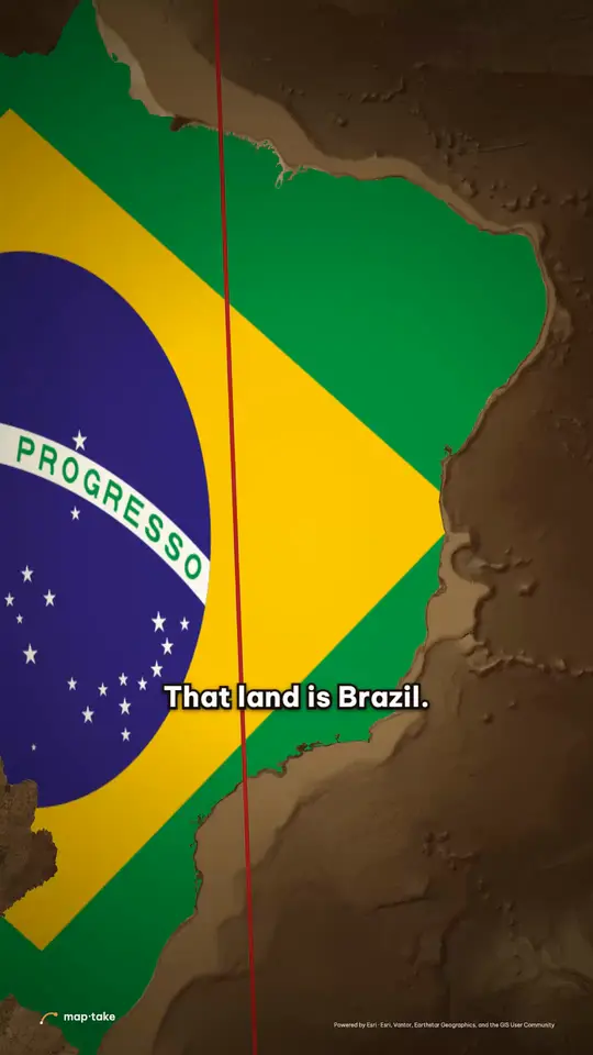 The Treaty of Tordesillas and Brazil’s language History · 9:16 · 36 s Spain and Brazil filled with their flags, one treaty line down the Atlantic.
-
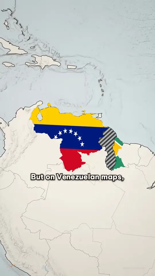 The Essequibo, one land on two maps Borders · 9:16 · 35 s Two flags, and a grey hatch (not a flag) for the land both sides talk about.
Flag images are from Wikimedia Commons. Outlines of small places are from OpenStreetMap contributors.
Questions people ask
- What is a flag map animation?
- A map video where each country’s flag fills the shape of that country, so the viewer sees at once which country is which. Short videos about borders use it in the first seconds (“This is Egypt. And this is Sudan.”), then the camera drops onto the odd place the story is about.
- Do I need After Effects or GEOlayers to put a flag inside a country?
- No. Maptake runs in the browser: you add the country’s boundary from built-in map data, fill it with the flag image or clip the flag with a matte, and export an MP4. Nothing to install and no plugin.
- Can an AI make a flag map animation for me?
- The seven Shorts on this page were built by an AI model that drives the Maptake editor over MCP: it wrote the script with a source for each fact, then added the shapes, flags, mattes, camera shots and voice clips as ordinary layers. You can connect your own AI app the same way, and you can open any of the projects to see how it is set up.
- Where do I get flag images?
- Wikimedia Commons has a PNG or SVG of almost every national flag. Each file page states its licence and any credit it asks for. Use the image of the flag you mean: a country’s flag and the flag of one of its regions are different files.
- Can I put a flag inside a small place, such as an island or a town?
- Yes. Search for it and add its boundary. If the built-in data has no outline for it, import one as GeoJSON, for example from OpenStreetMap (credit OpenStreetMap contributors). The Hans Island and Pheasant Island videos do this.
- Can I put two different flags on one shape?
- Yes. Give two flag images the same matte shape and show them one after another with clips, as the Pheasant Island video does. To split a shape in two halves with a flag each, cut its outline along a line first, as the Hans Island video does.
- How do I show a disputed place without taking a side?
- Do not fill it with either flag. Draw it with a neutral grey hatch, word each side’s position as that side’s position (“Venezuela claims it”, “Guyana governs it”) and give a source for each date. The Essequibo video does this.
- Why two voices?
- It is a choice, not a rule. The Bir Tawil Short, with a narrator and a second, deeper voice for the closing line, had about 2,000 views and 65% of viewers stayed to watch, in YouTube Studio on 21 November 2026. A different voice marks the moments that matter: the place name and the last line.
- Is it free?
- You can build and preview on the free plan, which has 100 AI credits a month. Free exports are up to 1280 px and 10 seconds, with a watermark, for personal use. Pro exports up to 3840 px (4K) and 3 minutes.
Put your first flag on a map
Open the editor free, add a country and give it its flag. The free plan needs no card.
Related
Map data © OpenStreetMap contributors, Natural Earth. Tiles © Protomaps. Satellite imagery: Esri.