

Alternatives
A GEOlayers alternative with an AI agent that runs in your browser
GEOlayers animates maps inside After Effects or in a web app. With Maptake’s AI agent you describe the video, and the agent plans it, picks a look, places the stops, borders and routes and sets the camera shots. You then fine-tune any layer on the timeline before exporting. Choose GEOlayers if you live in After Effects.
Watch how “Rama’s route: Ayodhya to Lanka” was built
How do I make a map animation with AI, without After Effects?
Describe the video in the chat, and the agent plans it and builds it on the timeline in the browser. No After Effects is involved, and every layer stays editable.
- 94 s
- narrated 16:9 video
- 16
- scenes, each with its own camera move
- 53
- words in the request
- 23
- labels placed on the map
This is the request this example was planned from:
“YouTube video, 16:9, 92 seconds: Rama’s 14-year exile on a real map, from Ayodhya to Lanka, through the places tradition links to the Ramayana. Epic and reverent, like a plate from an old atlas of ancient India; the route is the hero. I already have the voice-over, so time the picture to it.”
It names the route, the length, the frame, the look and the feeling, and it says there is a voice-over to time the picture to. That is the kind of detail that makes a request work.
The agent works in this order, the same as in the app’s chat:
- Plan. It writes the story, the feeling and the camera shots. Here: awe at how far the road is, then one reveal as the last line reaches Lanka.
- Places and data. It finds the stops on the road, from Ayodhya through Prayagraj, Chitrakoot, Panchavati and Hampi to Lanka, and draws the route between them.
- Look. It picks one design system: an old atlas plate, brown ink on cream paper, with one vermilion road.
- Scenes, one by one. It builds each scene on the timeline: the route, the place labels, two images and the camera shots.
- Review. It checks frames of the result against the plan and corrects what does not match.
- Done. You get an ordinary project. This one has 23 camera shots, 23 labels and 11 lines.
Then you edit by hand:
- Retime a camera shot or change its easing.
- Retype a label or move a stop.
- Add your own audio on the timeline.
This example was planned by one AI model and built by another with the editor’s own tools, not by the agent inside the app. The in-app agent works with the same tools. The narration is an AI voice and is not in the project.
What did one request turn into, scene by scene?
The plan gave every scene a feeling and a camera speed before anything was built. The ribbon shows that speed across the video, and the frames below are the real result: slow glides carry the road, and quick moves only get you from one place to the next.
- glide
- rush
- slam
- reveal
- taller bar = faster camera
-
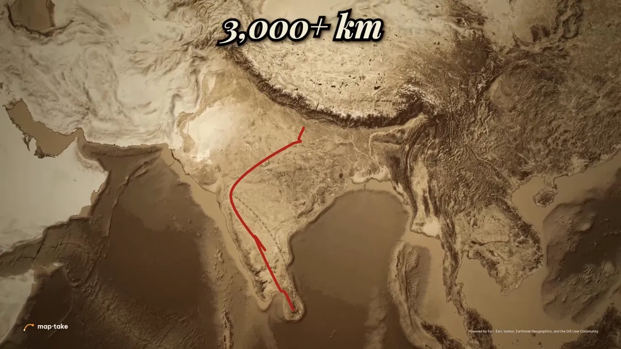
 0:00 High over India glide · slow
-
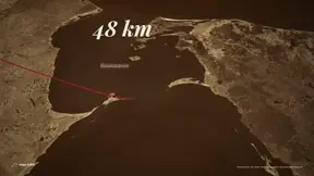
 0:02 The straight line to Lanka glide · slow
-
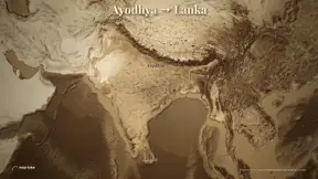
 0:06 A slow turn glide · medium
-
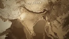 0:13 Slam down to Ayodhya slam · very fast
-
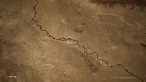 0:15 Along the Sarayu glide · slow
-
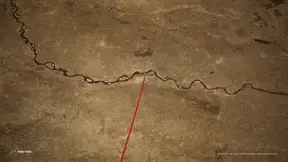 0:23 Over the Ganga glide · slow
-
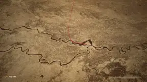 0:28 Where the rivers meet glide · slow
-
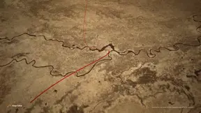 0:34 Forested hills glide · very slow
-
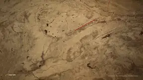 0:41 Rush to Panchavati rush · fast
-
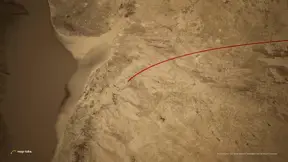 0:50 Slam in on Nashik slam · very fast
-
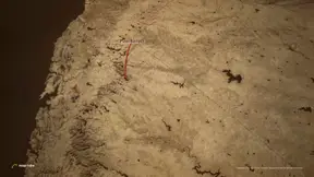 0:52 Rush to Lepakshi rush · fast
-
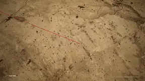 1:00 Boulder country glide · slow
-
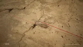 1:05 Rush to Rameswaram rush · fast
-
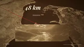 1:09 Low over Adam’s Bridge glide · very slow
-
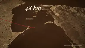 1:19 The road reaches Lanka glide · slow
-
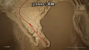 1:21 Lift to the whole road reveal · reveal
Frames and speeds come from the example project and its camera plan. Swipe the row on a phone.
Is the result a flat video, or a project you can edit?
The MP4 is only the export. Underneath is a normal project, and the agent made it with the editor’s own tools, so every camera shot, label and route is a layer on the timeline, drawn here from the project itself.
Camera one tile per scene
Labels place names, numbers, photo credits
Routes each leg appears when the road reaches it
Because they are ordinary layers, you fix an agent’s draft the same way you would fix your own: retime a shot, retype a label, move a stop.
Does AI-made mean one look? Same agent, six looks
These were made the same way as Rama’s route: one AI model wrote a design system and a camera plan, another built it in the editor with the editor’s own tools. The last three are five-second looks, not finished videos.
-
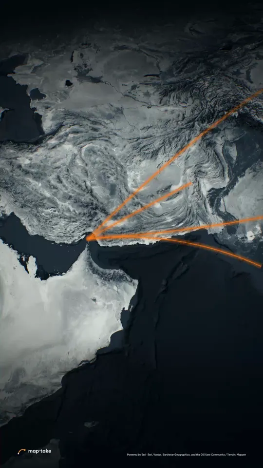 The Strait of Hormuz Explainer · 9:16 · 30 s
-
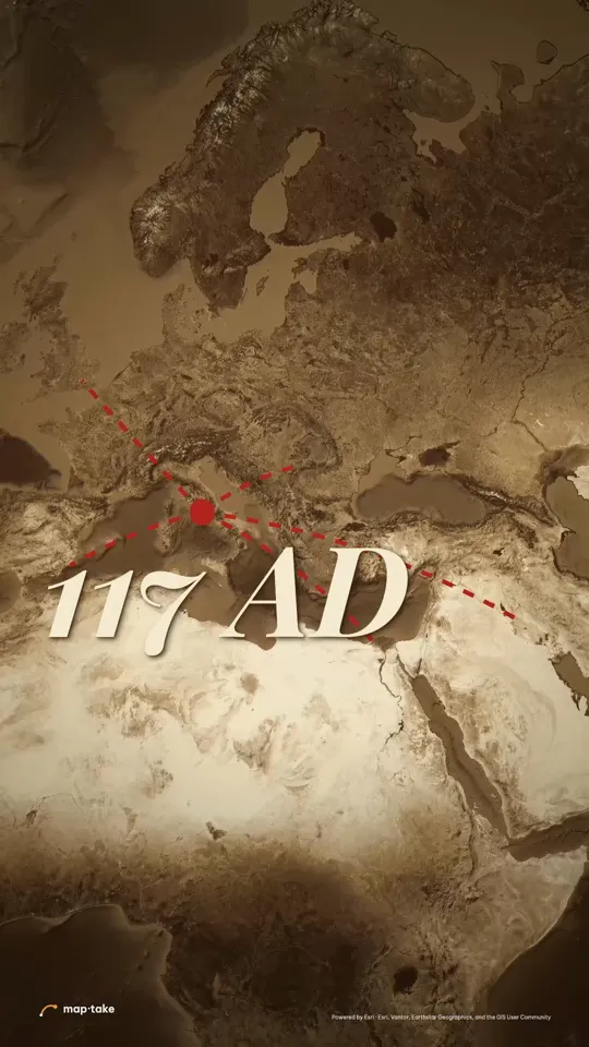 How far Rome reached History · 9:16 · 30 s
-
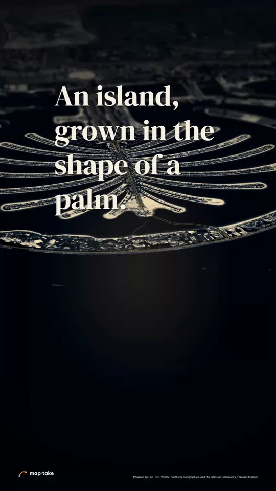 Palm Jumeirah, grown from the sea Travel · 9:16 · 23 s
-
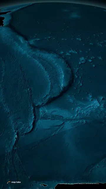 Abyss Look · 5 s test
-
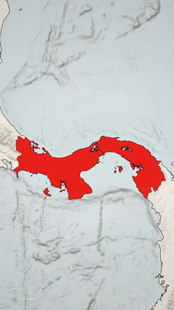 Front Page Look · 5 s test
-
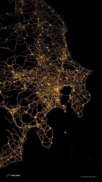 Gold Wire Look · 5 s test
Open any of them as a project and change it. The map styles page shows all eight looks.
Which one should you choose?
Choose by where you work. The plugin suits people who already live in After Effects. Maptake suits people who do not want to.
| Choose GEOlayers if… | Choose Maptake if… |
|---|---|
| You already finish every video in After Effects and want the map inside your project, next to the rest of your effects. | You do not use After Effects, or you edit in CapCut, Premiere or DaVinci Resolve. |
| You already know GEOlayers and its workflow. | You want an agent to draft the first version (places, borders, routes, camera) and then edit it by hand. |
| You rely on third-party tutorials for GEOlayers. | You want 4K, satellite and 3D terrain on the Pro plan. |
| You need something Maptake lacks: KMZ or shapefile import, or projections beyond Mercator and globe. | You want map data included in the plan. |
How do GEOlayers and Maptake compare at a glance?
Checked 8 November 2026. Sources are listed at the end of the page. Plugin and web app are two separate GEOlayers products.
| GEOlayers 3 plugin | GEOlayers web app | Maptake | |
|---|---|---|---|
| Runs in | After Effects | Your browser | Your browser |
| Free plan | A trial is listed on aescripts.com; see the vendor page for its terms | 5 projects, 1280 px, 10 s clips, non-commercial | 100 AI credits a month, 1280 px, 10 seconds, watermark, non-commercial |
| AI agent that builds the draft | No built-in agent | None mentioned on its public pages | Yes. The agent drafts the video; every result stays editable on the timeline |
| Export size and length | Set by After Effects | Pro 2048 px and 1 min. Studio 4096 px and 10 min | Pro 3840 px (4K) and 3 minutes. Studio 3840 px (4K) and 10 minutes |
| Export formats | Whatever After Effects renders | MP4 and lossless 4K image sequences | MP4 or WebM. CapCut pack (one MP4 per shot). After Effects pack on Pro |
| Globe and 3D terrain | 3D terrain is shown in vendor-side tutorials. A globe is not listed on its public pages | Studio plan | Globe on every plan. 3D terrain and satellite in exports on Pro |
| Map data | MapTiler data for 2 weeks after purchase, then a separate map data plan (a custom MapTiler licence for TV, film or channels over 100,000 subscribers) | Its home page does not name a map data provider | Included in every plan |
| Where the map lives | In your After Effects project | In a web app project | In a Maptake project, with an optional After Effects pack on Pro |
Where is GEOlayers better?
- The map lives in After Effects. If the rest of your video is built there, the plugin keeps everything in one project, with every effect you already use.
- Tutorials are easy to find. GEOlayers tutorials are on YouTube and on reseller sites such as Toolfarm.
- More export types on its home page. The web app lists lossless 4K image sequences and voiceover recording in the app. Maptake exports a single video as MP4 or WebM, with PNG sequences only inside the After Effects pack.
- Data formats and projections. Maptake imports GeoJSON, GPX, KML and TCX, but not KMZ or shapefiles yet, and offers Mercator and globe only.
Where is Maptake better?
- No After Effects. It runs in the browser and exports an MP4.
- An AI agent drafts the video (see it scene by scene). Describe the story and it plans it, picks a look, places the borders, routes and labels and sets the camera shots, and you keep control on the timeline.
- 4K, satellite and 3D terrain on Pro. The GEOlayers web app has 2048 px on Pro, and 3D terrain and the globe on Studio.
- Map data is included in every plan.
- CapCut and After Effects packs. One MP4 per shot for CapCut; on Pro, map and labels as separate layers plus a script that builds the comps.
For history and news videos in particular, see the war map animation guide and the examples.
Where does the agent fall short?
- It drafts; you check. Names, borders and dates in a history or news video need a source check, as in any first draft.
- This page shows one result, not a promise. Rama’s route was made with the editor’s own tools by one AI model following another’s plan, not by the agent inside the app. Run one request on the free plan (100 AI credits a month) and judge that.
- Data and projections. No GEOlayers projects, KMZ or shapefiles, and Mercator and globe only (see above).
How do I move over from GEOlayers?
- Export your boundaries and routes as GeoJSON, GPX or KML, and your tables as CSV.
- Import them in Maptake with “Feature”, then “Import a file”, in the Add dock, or describe the video and let the agent draft it, then edit it on the timeline.
- Rebuild the look with Maptake’s layers and set the camera shots.
The switching guide lists each GEOlayers concept and its Maptake name. Rama’s route, above, is a narrated example made with Maptake.
Sources
Questions people ask
- Can I import a GEOlayers project?
- No. Maptake cannot read GEOlayers projects or After Effects compositions. Bring the data instead, as GeoJSON, GPX, KML or CSV, and rebuild the look with Maptake layers.
- Is Maptake affiliated with GEOlayers?
- No. Maptake is independent and is not affiliated with or endorsed by GEOlayers, MapTiler or Adobe.
- Do I need After Effects?
- No. Maptake runs in the browser and exports an MP4 directly, and an MP4 opens in Premiere, DaVinci Resolve, CapCut or any other editor. The After Effects pack on Pro and the CapCut pack (one MP4 per camera shot) are optional.
- Can AI build a map video like a GEOlayers one?
- Maptake’s agent can build a first draft from a description: it plans the story, picks a look, places the places, borders and routes and sets the camera shots. The GEOlayers plugin has no built-in agent, and its web app mentions none on its public pages. Judge the result as you would any draft, and fix what is off by hand.
- Can I edit what the AI made?
- Yes. The agent uses the editor’s own tools, so every route, label, boundary and camera shot is a normal layer on the timeline. Edit it the way you would edit a project you built yourself.
- Is there a free plan?
- Yes. The free plan has 100 AI credits a month and exports up to 1280 px and 10 seconds, with a watermark, for personal use. The GEOlayers web app also has a free plan.
- Which is better for YouTube documentaries?
- It depends on how you work. If you cut documentaries in After Effects and want the map inside that project, the plugin fits. If you want a finished map sequence with audio from the browser, or an agent to draft it first, Maptake fits.
Try Maptake on your own route
Open the editor free, describe one scene to the agent and fine-tune it. The free plan needs no card.
Related
Map data © OpenStreetMap contributors, Natural Earth. Tiles © Protomaps. Satellite imagery: Esri.
GEOlayers, MapTiler and Adobe After Effects are trademarks of their respective owners. Maptake is not affiliated with or endorsed by them.