

How-to
How to animate a route on a map with AI, then fine-tune it by hand
A route animation is a line that draws itself across a map while the camera follows, often with a moving icon at its head. You need the route’s shape (stops, a GPX track or real roads), a way to reveal it over time and a camera move. In Maptake you describe the trip to the AI agent, then fine-tune it.
Watch how “How the Panama Canal lifts ships” was built
How do I animate a route with AI?
Describe the trip, or the thing you want to explain, and say what the viewer should feel. The agent decides where the line goes, how it is drawn and where the camera is while it draws.
This is the request this example was planned from:
“How does the Panama Canal actually work? 30 seconds, make it feel like crazy engineering.”
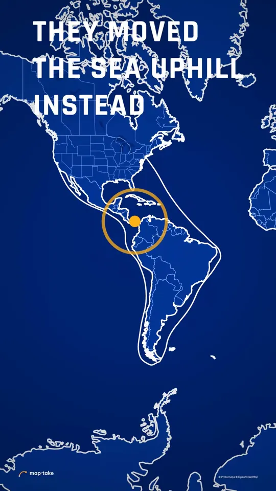
The request never asks for a route. The plan chose one: a thin amber line crosses the narrow neck of land, the camera pulls back to the whole continent, and a long white line draws around the bottom of South America. That is the voyage the canal removes, so the picture is a short amber line against a long white one.
The agent works in this order, the same as in the app’s chat:
- Plan. It writes the story, the feeling and the camera shots. Here the feeling was respect for an absurdly bold idea, and the message was that they lifted the ships over the mountain instead of cutting through it.
- Places and data. It finds Colón, the Gatun Locks, Balboa, New York, San Francisco and Cape Horn, and two facts to show on screen: the lake sits about 26 m above the sea and a transit takes 8 to 10 hours.
- Look. It picks one design system: a blueprint, with white linework on deep blue and amber for the canal.
- Scenes, one by one. It builds seven scenes: a low glide along the canal, a slam up to the whole neck, a slow slide from Colón to Gatun, a slam to the Pacific locks, the run to the Pacific, a pull back to both Americas and a slow zoom in.
- Review. It checks frames of the result against the plan and corrects what does not match.
- Done. You get an ordinary project. This one has 8 camera shots, 10 labels, 6 routes and lines and 2 areas.
Then you edit by hand:
- Retime how long a line takes to draw, or change its colour and Mode.
- Swap the ship for another icon, or move the stop labels.
- Replace a drawn line with your own GPX, KML or TCX track.
This example was planned by one AI model and built by another with the editor’s own tools, not by the agent inside the app. The in-app agent works with the same tools. The white line around Cape Horn is drawn by hand on the water and is illustrative: it makes no claim about the exact distance.
What makes a route animation read well?
Three parts carry it: the line, the head of the line and the camera.
- The line. Give the route one colour that means “the route”, and draw it on over time instead of showing it all at once. In the Panama video the canal is amber and nothing else in the frame is. The amber line draws from Colón to Gatun between 5.1 and 12 s and finishes at Balboa by 19 s.
- The head. Put something at the front of the line so the eye has a thing to follow: a ship, a car, a plane or a plain dot. In the Panama video a small white ship rides the amber line from Colón to Balboa.
- The camera. Glide slowly along the line, move fast to the next leg, and pull back at the end to show the whole trip.
The Panama camera score does all three. From 0 to 4.5 s the camera glides low along the canal near Gatun. At 4.5 s it slams up to the whole neck of land in 0.6 s, then slides slowly along the canal from 5.1 to 12 s. At 12 s it slams to the Pacific locks, and from 12.6 to 19 s it follows the line to the Pacific. At 19 s the camera rises to take in both Americas, and from 21.6 s the long white line draws around Cape Horn. The last five seconds are a slow zoom in toward the canal.
The slow parts make the fast parts land. The watch page has the full score, second by second.
How do I fine-tune a route by hand?
Open the project and work on the timeline. To build a route from nothing, without the agent, follow the same steps:
- Add a route layer. In the Add dock, choose “Route” (“Draw a line or a loop on the map”). Click the map to add points, click the last point again to finish, then press “Done”.
- Choose how the line travels. In the Path section, set “Mode” to “Great circle (true flight path)”, “Arc”, “Straight”, “Smooth curve” or “Bezier handles”. For a road trip, put points along the road, or ask the agent to route between your stops along real roads.
- Or import a recorded track. In the Add dock, choose “Feature” and then “Import a file”, and pick a GPX, KML or TCX file. It becomes a Feature layer that draws the recorded path.
- Draw the line on. Animate “Trim end” from the start of the line to the full line over the seconds you want it to take. Animate “Trim start” as well to make a short line that travels instead of growing.
- Put a moving icon on the head. On a Route layer, open “Line head”, choose a “Vehicle” or your own image, Lottie file or .glb model, and set “Turning” to “Follow line”. For an imported track, add a label or a 3D model and use “Follow a layer” to send it along the line.
- Make the camera follow. In the Camera layer, add a shot, choose “Follow a layer”, pick the route and set “Mode” to “Along the line”. Add a wider shot at the end.
- Export. Open “Export video” and choose “One video” for an MP4.
Open the Panama project in the editor to see the draw-on, the ship and the camera shots as layers.
Which kind of route for which trip?
The route type decides where the line goes and how it looks. Pick the one that matches how the trip really travels.
| Route type | Use it for | How it looks |
|---|---|---|
| Real roads | A road trip, a cycling or walking tour, a commute | The line follows the streets. Ask the agent to route between your stops by car, motorbike, bicycle or on foot. |
| Rail | A train journey between stations | The line follows a rail route from OpenStreetMap. It can be approximate, so check it. |
| Flight arc | A flight between cities or continents | A great-circle line that bends over the map, the way long-haul flights go. Pull back to the globe for long trips. |
| Sea route drawn by hand | A ship crossing, a historic voyage, a route with no road to follow | A smooth curve you place point by point over the water. The Cape Horn line in the Panama video is drawn this way. |
| Your own GPX or TCX | A run, ride or hike recorded on a watch or in Strava | The exact recorded path, imported as a Feature layer. |
For flights, the globe animation guide covers the pull back to the whole Earth. The travel map animation page covers trips with stops, photos and a moving plane or car.
Route videos made in Maptake
Each of these opens as an editable copy in your account, on any plan. Change the places, the words and the timing, and keep the look.
-
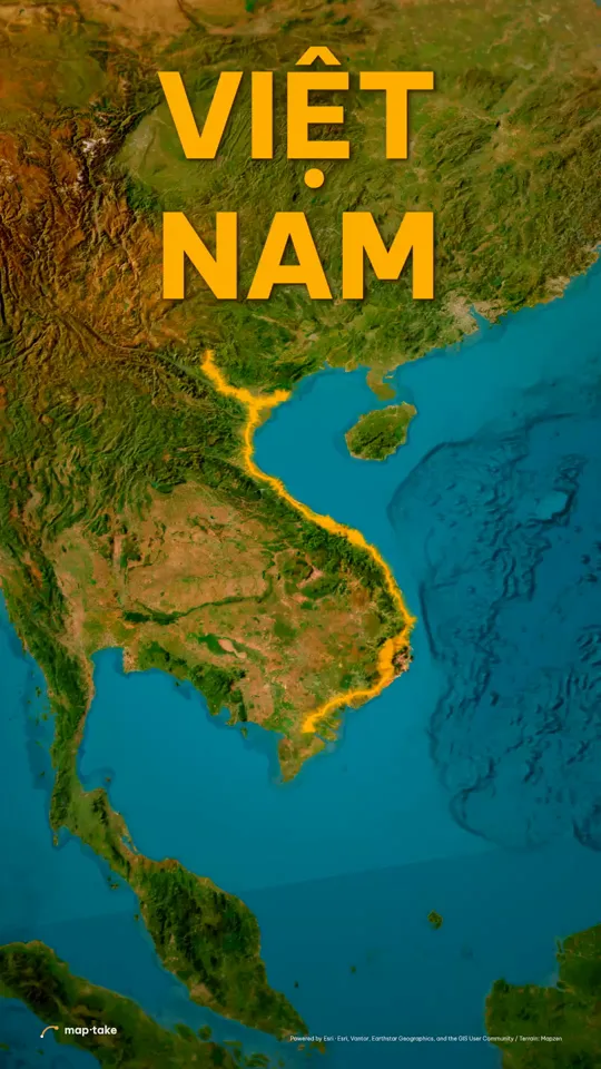 Việt Nam, one long curve Travel · 9:16 · 40 s One gold line down the whole country, from the northern mountains to the Mekong.
-
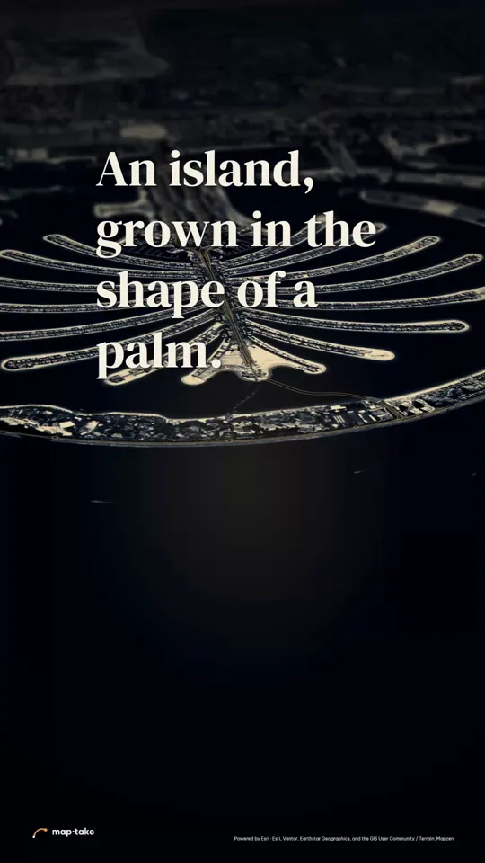 Palm Jumeirah, grown from the sea Travel · 9:16 · 23 s A monorail route drawn up the trunk of the palm.
-
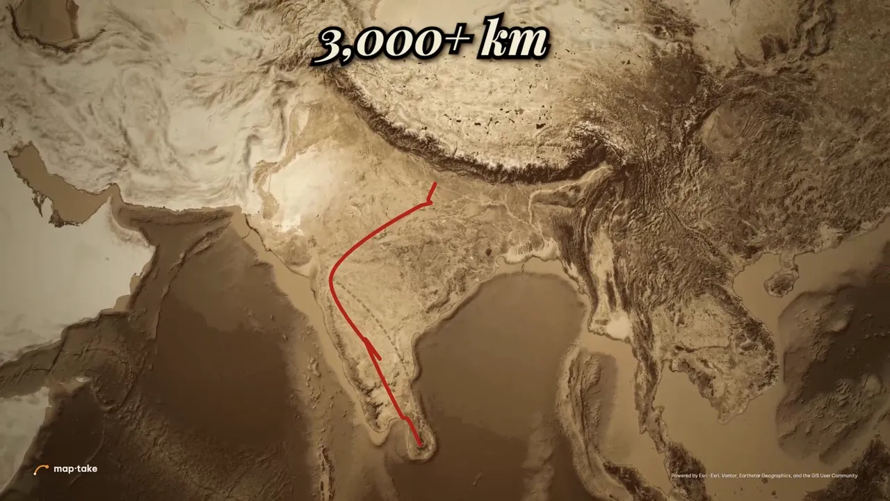 Rama’s route: Ayodhya to Lanka History · 16:9 · 94 s A 16:9 story: a red road from Ayodhya to Lanka, timed to a voice-over.
-
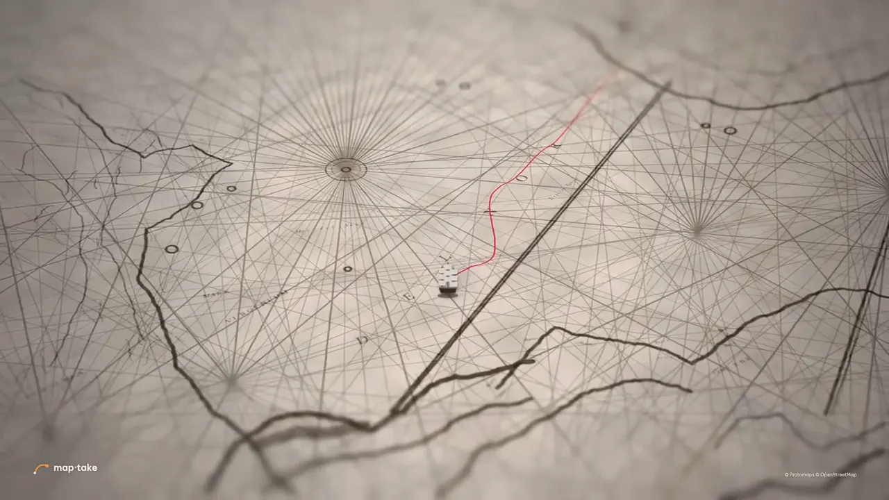 A route on an old paper map History · 16:9 · 3 s A route on a tilted antique map, built by hand from a popular tutorial.
The first three were built by AI models using the editor’s own tools. The old paper route was built by hand.
Questions people ask
- Can AI animate a route on a map?
- Yes. Describe the trip and the agent plans the camera shots, finds the places, draws the line and builds the scenes on the timeline. You can also name the route you want: the stops, a road trip, a flight or a sea crossing. Check the places and the line, and retime anything by hand.
- Can I animate a GPX or Strava route?
- Yes. Strava and Garmin both export an activity as a GPX file. Import it from “Feature” and “Import a file” in the Add dock and it becomes a line you can draw on with trim and restyle. There is no direct link to a Strava or Garmin account.
- Does the route follow real roads?
- It can. The agent can get the real road between your stops for driving, walking, cycling or motorcycling, and a rail line between stations, so the line follows the streets. Rail lines come from OpenStreetMap routes and can be approximate, so check them. By hand you place the points yourself, or import a recorded track.
- Can a car, plane or ship move along the line?
- Yes. A Route layer has a “Line head”: pick a plane, helicopter, car, bus, truck, motorbike, bicycle, train, ship, boat, walking figure, arrow or dot, or your own image, Lottie file or .glb model. It turns with the line. On an imported track, a label or a 3D model can follow the line instead.
- Can the camera follow the route?
- Yes. A camera shot can follow a route layer along the line, so the view travels with the route. Slow shots along the line and a fast move to the next leg give the usual rhythm. Finish with a wider shot so the viewer sees the whole trip.
- Can I edit what the AI made?
- Yes. The agent uses the editor’s own tools, so the route, the moving icon, the labels and every camera shot are normal layers. Redraw the line, change its Mode, retime the draw-on, swap the ship for a car or replace the line with your own GPX file.
- Is it free?
- You can build and preview route animations on the free plan. It exports up to 1280 px and 10 seconds, with a watermark, for personal, non-commercial use. Pro goes up to 3840 px (4K) and 3 minutes. See the plan limits on the pricing page.
Animate your route
Open the editor free, describe your route to the agent and fine-tune the line and the camera. The free plan needs no card.
Related
Map data © OpenStreetMap contributors, Natural Earth. Tiles © Protomaps. Satellite imagery: Esri.