

How-to
How to highlight a country on a map with AI, then fine-tune it by hand
To highlight a country on a map you need its boundary as a shape, a fill or outline that stands out, and an animation that brings it in. With Maptake’s AI agent you describe the video; it finds the boundary in built-in map data and builds the highlight. You then adjust colour, timing and camera on the timeline.
Watch how “Africa at its true size” was built
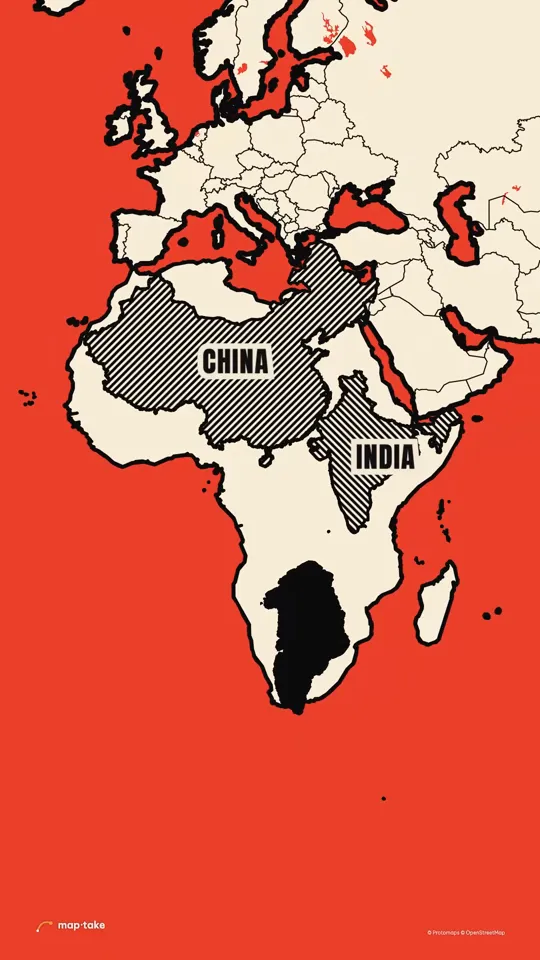
In the clip above, the wow moment runs 8–15 s: real shapes of big places slide over and drop inside Africa, one after another, at true size, and there is still room.
How do I highlight a country with AI?
Name the country, or the comparison, and say what the viewer should feel. The agent finds the boundary, picks a look, builds the highlight on the timeline and sets the camera.
This is the request this example was planned from:
“Show how big Africa really is. Maps lie. 20s, make it surprising and a bit funny, something people will send to their friends.”
The request does not say how to show the size. The plan chose it: real shapes of big places slide over and drop inside Africa, one after another, at true size.
The agent works in this order, the same as in the app’s chat:
- Plan. It writes the story, the feeling and the camera shots. Here the feeling was “wait, what? I have to send this”, and the message was that the map you grew up with has been shrinking Africa.
- Places and data. It finds Africa, Greenland, China, India, the United States and the countries of Europe, and takes their real outlines.
- Look. It picks one design system: a flat poster map on a red sea, with cream land and a thick black coast.
- Scenes, one by one. It builds Greenland looking huge, then sliding onto Africa at true size, then China at 8 s, India at 9.6 s, the USA at 11.2 s and Europe’s countries at 12.8 s, each with its own pattern and a one-word tag.
- Review. It checks frames of the result against the plan and corrects what does not match.
- Done. You get an ordinary project. This one has 14 camera shots, 9 labels and 6 areas.
Then you edit by hand:
- Change a fill, a pattern or an outline, and retype a tag.
- Retime when each shape lands, or change how it fades in.
- Swap a shape for another country by searching it and adding its boundary.
This example was planned by one AI model and built by another with the editor’s own tools, not by the agent inside the app. The in-app agent works with the same tools.
What are four ways to make a country stand out?
Most highlights use one of four looks. They are all settings on the same Feature layer, so you can switch between them on the timeline.
| Way | Use it when | Where to set it |
|---|---|---|
| Fill it with one colour | The country is the subject of the shot. | In “Feature style”, under Area, set “Fill”. Add a “Pattern”, a “Gradient” or an “Image” (a flag, say) for a richer look. |
| Outline only | The country is context, or the map under it is satellite and you want to keep it visible. | Turn “Fill” off and keep “Stroke” under Line. Add “Glow” for a neon edge. |
| Dim everything else | One country matters and the rest of the map should step back. | Turn on “Invert” on a copy of the boundary: it fills the area outside the shape, so a dark fill darkens the rest of the map. On a satellite map, “Satellite photo” can darken or tint the photo around a subject. |
| Lift or tilt it | You want a 3D look. | Tilt the camera with “Pitch” in a Camera shot, as the Libya example does. Or set “Lift” (metres above the ground) and “Thickness” on the area, so it floats as a plate with real parallax when the camera tilts. |
For a fill, see the Africa video, where the continent is one flat cream shape on a red sea. For a tilted 3D look, see Libya on a tilted 3D map: it was built by hand, with the camera tilting and turning over a paper-style map.
How do I fine-tune a highlight by hand?
Open the project and work on the timeline. To highlight a country from nothing, without the agent, follow these steps:
- Type the country in the search bar (“Search places, regions, countries or coordinates…”), open the result and choose “Boundary” (“Add the boundary as a feature”). The shape comes from built-in map data, which shows today’s borders.
- Select the new Feature layer and open “Feature style”. Under Area, set “Fill”. Under Line, set “Stroke” and, if you want a neon edge, “Glow”. For an outline-only look, turn “Fill” off.
- Add the boundary a second time, turn on “Invert” and give it a dark fill. It covers everything outside the country, so the highlighted copy stands out.
- Select the clip and set its Transition: “Fade” for opacity, and “Draw on” to trace the outline, for example “From start”. Place the clip on the timeline at the moment the shape should appear.
- Add a Camera shot that frames the country, with an easing curve. For a 3D look, raise “Pitch” in the shot.
- Open “Export video” and choose “One video” for an MP4. A vector map exports on every plan.
Can I compare countries at their true size?
Yes. A shape can be moved to another place and keep its real size and shape. The Africa video does exactly this: Greenland slides down onto Africa and shrinks to its true size, then China, India, the USA and Europe’s countries drop inside it.
On a flat map a shape moved north looks bigger, because the flat map stretches the far north. That is the size the map really shows, not a mistake. Ask the agent for the comparison, name the places and the order, and it places each copy for you. The Africa watch page has the second-by-second score.
What about regions, states and my own shapes?
- Regions, states and cities. Search for them like a country and add their boundary from built-in data.
- Many regions at once. Import a CSV or TSV table and join it to the boundaries, so a column of numbers can set how each region is coloured.
- Historical borders. Built-in data is today’s borders. For another date, import your own GeoJSON or KML: “Feature”, then “Import a file”, in the Add dock.
- Disputed borders. Say on screen that a border is disputed, in a label or a different line style.
Highlight videos made in Maptake
Each of these opens as an editable copy in your account, on any plan.
- Africa at its true size Geography · 9:16 · 20 s China, India and the USA dropped inside Africa at true size, on a flat poster map.
-
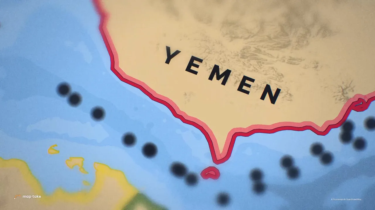 Yemen on a paper map Explainer · 16:9 · 5.5 s Yemen’s Red Sea coast lit in red on a paper map. Built by hand.
-
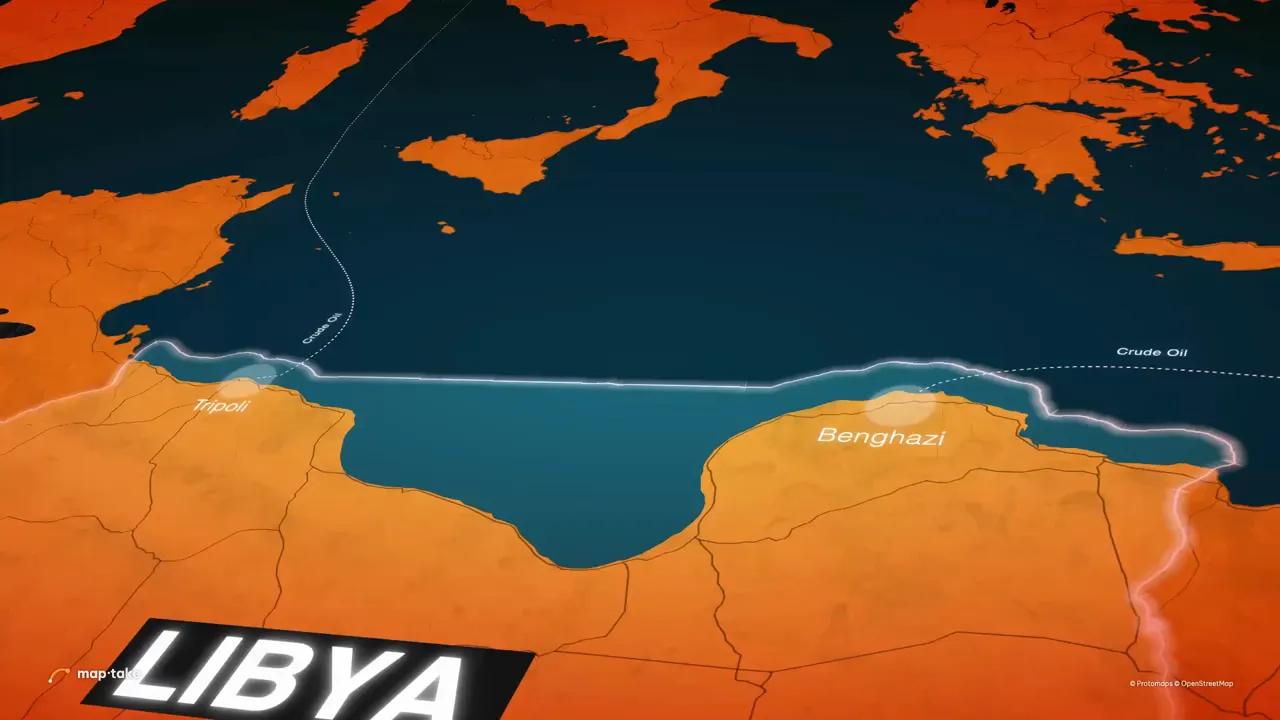 Libya on a tilted 3D map Geography · 16:9 · 10 s Libya in orange on a map tilted in 3D. Built by hand.
-
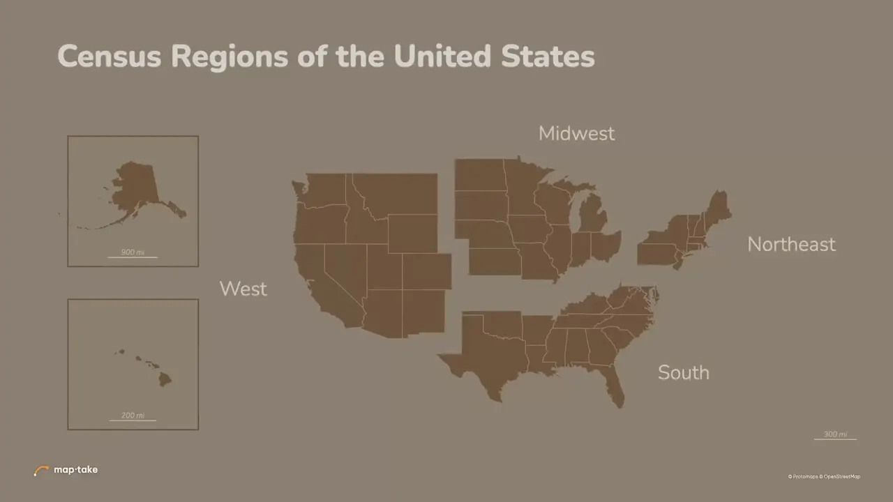 Census regions of the United States Data · 16:9 · 5 s The four US census regions, each with its own colour and label. Built by hand.
Yemen, Libya and the census regions were built by hand from popular After Effects tutorials. Africa was planned and built by AI models with the same tools.
Questions people ask
- Can AI highlight a country on a map?
- Yes. Describe the video and name the country, and the agent finds its boundary in built-in map data, picks a look and builds the highlight and the camera moves on the timeline. Check the result as you would check any map: the name, the border and the label text. Generic AI video apps draw a map-like picture instead, so a border can be invented.
- Can I highlight more than one country?
- Yes. Each country is its own Feature layer with its own style and timing, so they can appear one after another. The Africa video has 6 areas on its timeline.
- Can I highlight a state, a region or a city?
- Yes. The place search finds regions and cities as well as countries, and “Boundary” adds the shape of whatever you pick. To colour many regions from a table, import it as CSV or TSV, up to 3 MB, and join it to the boundaries.
- Can I animate the border being drawn?
- Yes. Set the clip’s “Draw on” transition, or animate “Trim start” and “Trim end” on the shape, and the outline traces itself around the country. “Fade” is on the same clip.
- Can I show historical or disputed borders?
- Built-in data is today’s borders. For 1914 or 1942 import your own GeoJSON or KML (“Feature”, then “Import a file”, in the Add dock), from a source that is dated. Mark a disputed border as disputed in a label, rather than choosing a side silently.
- Can I edit what the AI made?
- Yes. The agent builds with the editor’s own tools, so each highlight is a normal layer with a fill, an outline and a clip you can retime. You can fix it by hand, or ask the agent for a change in words in the same chat.
- Is it free?
- You can build and preview on the free plan, which has 100 AI credits a month. Free exports are up to 1280 px and 10 seconds, with a watermark, for personal use. Pro exports up to 3840 px (4K) and 3 minutes.
Highlight your first country
Open the editor free, name a country and describe the video to the agent. The free plan needs no card.
Related
Map data © OpenStreetMap contributors, Natural Earth. Tiles © Protomaps. Satellite imagery: Esri.