

Travel
Travel map animation with AI: describe the trip, then fine-tune it
A travel map animation draws a trip as a line across a real map while the camera follows it, with a moving plane or car. With Maptake’s AI agent you describe the trip; it plans the video, picks a look, places the stops and routes and sets the camera shots. You then fine-tune any layer on the timeline.
Watch how “Việt Nam, one long curve” was built
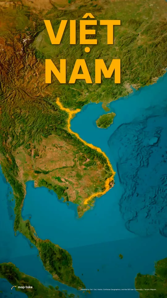
How do I make a travel map animation with AI?
Describe the trip in the chat: the places, the length, the frame and the feeling you want. The agent plans the video and builds it on the timeline, and every layer it adds stays editable.
This is the request this example was planned from:
“Make a 40s cinematic video about Viet Nam. I want people to fall in love with this country, from the mountains in the north to the Mekong in the south. Strong hook, energy, interesting story.”
It names the country, the length and the feeling. The plan that came out of it fixed a feeling (“love for a place the viewer has not yet seen”) and a message (“one country, one long curve, from clouds to river”) before any layer existed.
The agent works in this order, the same as in the app’s chat:
- Plan. It writes the story, the feeling and the camera shots. Here: a slow glide over each region, a fast slam to the next, one lift at the end.
- Places and data. It finds the places the story names (Ha Giang, Ha Long Bay, Hue, Hoi An, Da Lat, the Mekong) and the route between them.
- Look. It picks one design system for the whole trip: palette, fonts, base map, label and line styles. Here: warm light and one gold line.
- Scenes, one by one. It builds each scene on the timeline: the line, the labels and the camera shots.
- Review. It checks frames of the result against the plan and corrects what does not match.
- Done. You get an ordinary project. This one has 12 camera shots, 8 labels and 6 lines.
Then you edit by hand:
- Retime a camera shot or change its easing.
- Swap a stop, retype a label or add your own photos.
- Replace the route with your own GPX, KML or TCX file.
This example was planned by one AI model and built by another with the editor’s own tools, not by the agent inside the app. The in-app agent works with the same tools.
What makes a travel map video feel cinematic?
Two things carry it: one look for the whole trip, and one contrast in camera speed. Everything else is detail.
The Việt Nam video uses warm light and a single unbroken gold line from the northern mountains to the Mekong. Nothing else in the frame competes with that line.
The camera glides slowly over each place, then slams to the next. In the Việt Nam camera score, 0 to 6 s is a low glide over the Ha Giang ridges. At 6 s the camera slams to Ha Long Bay in 0.7 s and settles into another slow glide. Three more slams follow the same pattern. From 30 to 36 s the camera lifts until the whole S-curve of the country is in frame, with the gold line running from top to bottom.
Each of those moves is a camera shot on the timeline, so you can retime it or change its easing by hand. The watch page has the full score, second by second.
Travel videos made in Maptake
Each of these opens as an editable copy in your account, on any plan. Change the places, the words and the timing, and keep the look.
- Việt Nam, one long curve Travel · 9:16 · 40 s One warm look, one gold line from the northern mountains to the Mekong.
-
 Palm Jumeirah, grown from the sea Travel · 9:16 · 23 s A monorail route on a gold-glow map of Palm Jumeirah.
-
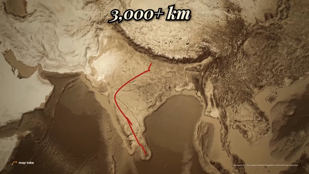 Rama’s route: Ayodhya to Lanka History · 16:9 · 94 s A 16:9 story with an old-atlas route, timed to a voice-over.
-
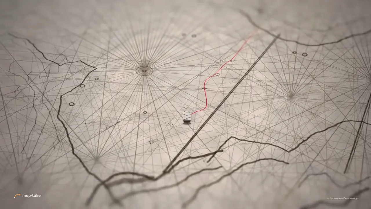 A route on an old paper map History · 16:9 · 3 s A route drawn on old paper, rebuilt by hand from a popular tutorial.
The first three were built by AI models using the editor’s own tools, so every layer is still editable by hand. Open the Việt Nam project in the editor to see how the shots are laid out.
How do I fine-tune a travel map animation by hand?
Open the project and work on the timeline. You can also build a trip from nothing, without the agent, in the same five steps:
- Pick the frame. 9:16 for Reels, TikTok and Shorts, 16:9 for YouTube.
- Add your stops. Search for a place (“Search places, regions, countries or coordinates…”) and add it as a label or a boundary. Or import a route file with “Feature”, then “Import a file”, in the Add dock: GPX, KML or TCX. Strava and Garmin both export GPX.
- Choose the route type. Draw the line as a great-circle arc, a straight line, an arc, a spline or a bezier curve, and pick the moving icon: a plane, car, bus, train, ship, bicycle, a walker, or your own image. Animate “Trim end” to draw the route on. For real roads, ask the agent to route between the stops.
- Set the camera, labels and photos. Add a camera shot for each stop and pick an easing curve (there are 11). “Follow a layer” with “Along the line” keeps the camera on the moving icon. Add an Image layer for each photo.
- Export an MP4. Open “Export video” and choose “One video”. The plan sets the size and length, see below. For a finish in CapCut, “CapCut pack” gives one clip per camera shot.
How do I make a flight path animation?
Draw the route as a great-circle line, and the plane flies it the way real long-haul flights do. A great-circle arc curves over the map because that is the shortest path on a sphere, so London to Tokyo bends north.
Put a plane on the line as its moving icon. It turns along the curve, and you can keep the camera on it with “Follow a layer”. For an intercontinental trip, finish by pulling back to the whole Earth so the viewer sees both ends of the journey. The globe animation guide covers that shot.
What does the free plan cover?
The free plan has the full editor and the agent, with 100 AI credits a month. Exports go up to 1280 px and 10 seconds, carry a watermark and are for personal, non-commercial use. Satellite imagery and 3D terrain are preview-only.
Pro exports up to 3840 px (4K) and 3 minutes, with your audio, satellite and 3D terrain, no watermark and commercial use on your own channels. It includes 1,000 AI credits a month. See all plans.
Questions people ask
- Can I animate my Strava or GPX route?
- Yes. Export the activity as a GPX file from Strava or Garmin and import it with “Feature”, then “Import a file”, in the Add dock. GPX, KML and TCX tracks become lines on the timeline, so you can draw them on and restyle them. To move an icon along an imported track, add a label or a 3D model and set it to “Follow a layer”.
- Does the route follow real roads?
- An imported GPX or TCX track follows the path that was recorded. For stops you name yourself, ask the agent to route between them: it can follow real roads for driving, walking, cycling, motorcycling or rail. By hand you choose a great-circle arc, a straight line, an arc, a spline or a bezier curve.
- Can I make a travel map video for free?
- Yes, within the limits of the free plan: 100 AI credits a month, export up to 1280 px and 10 seconds, a watermark, and personal use only. Pro lifts the size to 3840 px (4K), the length to 3 minutes, and removes the watermark.
- Which size for Instagram Reels and TikTok?
- Choose the 9:16 frame for Reels, TikTok and YouTube Shorts, 16:9 for YouTube, and 4:5 or 1:1 for feed posts. You pick the frame first, so the camera is planned for it.
- Can I add my own photos?
- Yes. Add an Image layer (png, jpeg, webp or gif) and time it to the moment the route reaches the place. Video clips (mp4, mov, webm) and audio files can go on the timeline as well.
- How do I write a good request for a travel map animation?
- Name the places, the length and the frame (9:16 or 16:9). Say the feeling you want and what the viewer should remember. The request quoted above does that in three sentences: the country, the length, the feeling and the route from north to south. A request with real stops and the mood you want works better than a generic one.
- Can I edit what the AI made?
- Yes. The agent builds with the editor’s own tools, so every route, label, photo and camera shot is a normal layer on the timeline. Retime a shot, change its easing, retype a stop name or replace the route with your own GPX file. Nothing is locked: the agent’s work and your own edits live in the same project.
Start your route
Open the editor free, describe your trip to the agent and fine-tune the result. The free plan needs no card.
Related
Map data © OpenStreetMap contributors, Natural Earth. Tiles © Protomaps. Satellite imagery: Esri.