

How-to
How to make a map animation with AI
There are two kinds of AI for map videos. AI video models draw a map-like picture. A map editor with an AI agent uses real map data: you describe the video, and the agent plans the story and camera, finds the places and builds scenes you can edit. Use the second when names and borders must be right.
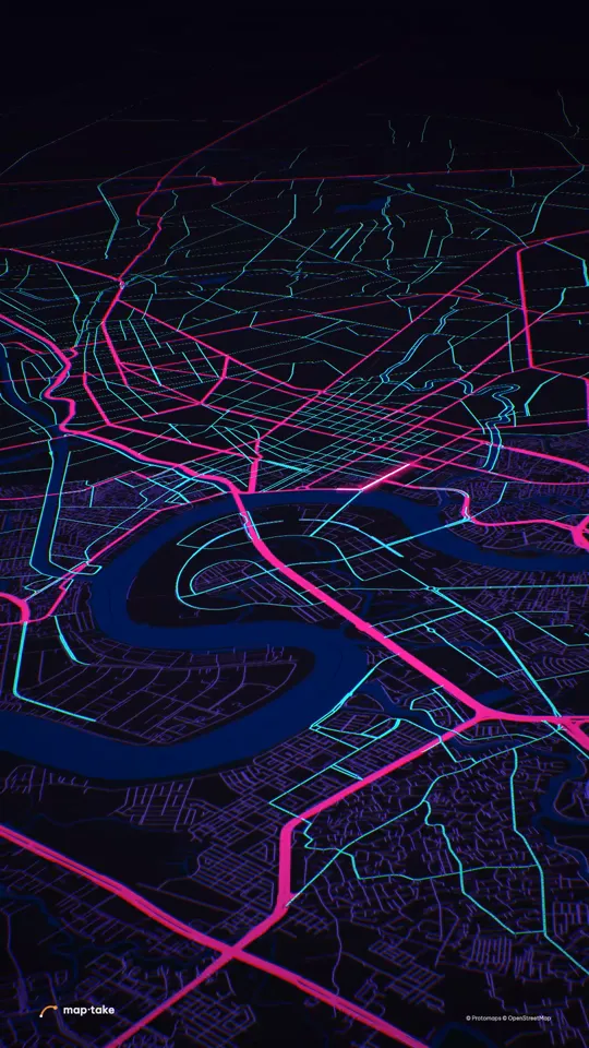
Watch how “Sài Gòn at 3 AM” was built
How does the agent make a map animation?
You describe the video in the chat: the subject, the length and what the viewer should feel. The agent plans it, finds the places, picks one look and builds the scenes with the editor’s tools.
This is the request the video above was planned from:
“Saigon at night, 20s, cyberpunk, neon energy. Make it the kind of video people share.”
The agent works in this order, the same as in the app’s chat:
- Plan. It writes the story, the feeling and the camera shots. Here the feeling was “this city is alive, I want to be there”, the message was that it is 3 AM and the city is still moving, and the wow moment was at 3.0 s: a dark city of silhouettes, one light racing through it. Then every road in the real city switches on at once, as the camera whips upward.
- Places and data. It finds Sài Gòn, the real street network and the river that cuts through it.
- Look. It picks one design system, Neon Grid: a dark city that switches on all at once, every street burning.
- Scenes, one by one. It builds the dark street-level opening with one light racing down a real road, the ignition at 3.0 s as the camera whips upward, the run along the river, and the pull back to the whole city as one glowing circuit at 13 to 16 s, with the name landing huge.
- Review. It checks frames of the result against the plan and corrects what does not match.
- Done. You get an ordinary project. This one has 8 camera shots, 5 labels and 22 routes and lines.
This example was planned by one AI model and built by another with the editor’s own tools, not by the agent inside the app. The in-app agent works with the same tools and follows the same steps.
What should I write in the request?
Four things are enough. The Sài Gòn request above has the subject, the length and the feeling in one line. The format is the fourth.
- The subject. A place, a route or an event: “Saigon at night”, “the Panama Canal”, “how far the Roman Empire reached”.
- The length. Seconds, as in “20s” or “30 seconds”.
- The feeling for the viewer. “Make people hold their breath”, “surprising and a bit funny”, “something people will send to their friends”.
- The format. 9:16 for Reels, TikTok and Shorts, 16:9 for YouTube. You can say it in the request, as the Rama’s route request does, or choose the frame in the editor.
You can add a look, facts you already have such as dates, numbers and sources, or a voice-over you want the picture timed to. You do not need to name camera moves or colours. The plan chooses them, and you change them afterwards if you want something else.
What are real requests, and the videos they became?
These nine requests are copied from the plans of nine example videos. Each row shows what the plan decided and links to the watch page, which has the full plan and the camera score. “Try this request” opens the editor with the request already typed in the description box. You still press send, so nothing runs and no credit is used until you do.
| Request | What the plan decided | Video | Try it |
|---|---|---|---|
| “30s video about the Strait of Hormuz. Make people feel why the whole world holds its breath when ships pass here. Cinematic,…” | 9.5–16 s: the camera leaps up off the strait into space, and as the whole Earth opens, ember lines shoot out from that one point to China, India, Japan and South Korea. | The Strait of Hormuz 9:16 · 30 s | Try this request |
| “Show how big Africa really is. Maps lie. 20s, make it surprising and a bit funny, something people will send to their friends.” | 8–15 s: real shapes of big places slide over and drop inside Africa, one after another, at true size, and there is still room. | Africa at its true size 9:16 · 20 s | Try this request |
| “Saigon at night, 20s, cyberpunk, neon energy. Make it the kind of video people share.” | 3.0 s: a dark city of silhouettes, one light racing through it. Then every road in the real city switches on at once, as the camera whips upward. | Sài Gòn at 3 AM 9:16 · 20 s | Try this request |
| “Make a 40s cinematic video about Viet Nam. I want people to fall in love with this country, from the mountains in the north to…” | 30–36 s: after flying the whole length of the country at low level, the camera lifts away and the entire S-curve appears, with one gold line running from top to bottom along it. | Việt Nam, one long curve 9:16 · 40 s | Try this request |
| “How does the Panama Canal actually work? 30 seconds, make it feel like crazy engineering.” | 19–25 s: a thin amber line crosses the narrow neck of land. The camera pulls back to the whole continent, and a long white line draws around the bottom of South America: the voyage the canal removes. Long white against short amber, in one picture. | How the Panama Canal lifts ships 9:16 · 30 s | Try this request |
| “How far did the Roman Empire actually reach? 30 seconds, epic. Hook me.” | 14–20 s: vermilion lines have been marching out of Rome one by one; the camera pulls back and the whole old-atlas Mediterranean opens with all of them reaching at once to the ends of the empire. The year lands: 117 AD. | How far Rome reached 9:16 · 30 s | Try this request |
| “Iceland in 25 seconds. Fire and ice. Make people want to book a flight tomorrow.” | 11–15 s: the camera slams out of a lava field and lands low over the biggest white ice cap, then rises until the black rock, the white ice and the glowing rift are all in one frame, with the whole island floating on a black sea. | Iceland, fire and ice 9:16 · 25 s | Try this request |
| “Make an elegant 22 second vertical video about Palm Jumeirah in Dubai, United Arab Emirates: an island built in the sea from June…” | 9.0–11.5 s: the camera rises and the whole palm lights gold at once in the dark sea; physical because the shape appears as one glowing object. | Palm Jumeirah, grown from the sea 9:16 · 23 s | Try this request |
| “YouTube video, 16:9, 92 seconds: Rama's 14-year exile on a real map, from Ayodhya to Lanka, through the places tradition links to…” | 75–86 s: the red road leaves Dhanushkodi and draws across open sea along the pale shoals of Adam's Bridge, low and slow; it touches Lanka at 79 s, then the camera rises until the whole subcontinent is in frame with the entire road from Ayodhya to Lanka lit at once. | Rama’s route: Ayodhya to Lanka 16:9 · 94 s | Try this request |
The nine videos were made in November 2026, before the agent shipped in the app: one AI model wrote each plan and another built it with the editor’s own tools. The Rama’s route video was also smoothed and reframed by us afterwards. The in-app agent works with the same tools. Long requests are shortened in the table, and the link carries the whole text.
What should I check after the agent is done?
Watch the video once with the plan open, and check these before you export:
- Place names and label text. Every name is typed text, so a wrong one is a quick fix.
- Borders. Built-in data is today’s borders. Import a dated GeoJSON for another year, and mark disputed borders as disputed.
- Numbers and dates. Compare each one with your source, and put the source on screen.
- Lines that are illustrative. A route drawn by hand on water is not shipping-lane data. Say so on screen.
- The first two seconds. This is where a viewer decides to stay. Something should already be moving.
How do I change the result?
Two ways, in the same project. Work by hand on the timeline: retime a camera shot, retype a label, change the look, swap a place. Or ask the agent for a change in words: the chat box takes “what to change” as well as a new description, and each reply from the agent is a take you can return to.
Every layer the agent made is a normal layer, so nothing is locked, and the agent’s work and your own edits live in the same project. See the guides for globe shots and highlighting a country for the by-hand steps.
Should I use a map editor with an agent, or an AI video model?
It depends on what the video has to do.
- AI video models are fast and good for a mood shot or an “earth zoom”. They draw pixels, so a label can be misspelled and a border invented, and nothing in the result is a layer you can edit.
- A map editor with an agent is slower to a first video, but the places come from map data and every part stays editable: the camera, the lines, the labels and the look.
If viewers will check the map, such as a history, news, geography or travel video, start in the editor. For a pure atmosphere shot with no names on it, a video model can be enough.
What does the free plan include?
The free plan has the full editor and the agent, with 100 AI credits a month. Exports go up to 1280 px and 10 seconds, carry a watermark and are for personal, non-commercial use. Pro exports up to 3840 px (4K) and 3 minutes. See all plans.
Questions people ask
- Can AI make a map animation?
- Yes, in two different ways. An AI video model draws a picture that looks like a map. A map editor with an AI agent, like Maptake, plans the story and the camera, finds the places in map data and builds the scenes as layers on a timeline. Use the second when names and borders must be right.
- Is the map accurate?
- The places, borders and roads come from map data, not from a drawn picture, so they sit where the data puts them. Built-in borders are today’s borders, and the agent can still pick the wrong place for an ambiguous name. Check names, label text, numbers and dates before you export, and say on screen when a line is illustrative.
- Which AI model does it use?
- Maptake is independent software. The agent runs on large language models from third-party AI providers that we choose, and we may switch as better ones become available. The current provider is listed in the Privacy Policy. The agent does not generate photos or video footage: every frame is rendered from map data, built-in graphics and the files you upload.
- Can I edit what the AI made?
- Yes. The agent builds with the editor’s own tools, so every camera shot, label, line and area is a normal layer. Retime a shot, retype a label or change the look by hand, or ask the agent for a change in words in the same chat.
- Can I use my own data or route?
- Yes. Import GeoJSON, JSON, GPX, KML or TCX with “Feature”, then “Import a file”, in the Add dock, and they become lines and areas. CSV and TSV import as data tables. KMZ and shapefiles are not supported yet, so convert them to GeoJSON first.
- Which languages can I write in?
- The editor is in 15 languages: English, Vietnamese, Spanish, Brazilian Portuguese, German, French, Russian, Simplified Chinese, Traditional Chinese, Japanese, Korean, Thai, Indonesian, Arabic and Hebrew. The agent answers in the language of your request. Check the spelling of any label you did not type yourself, and retype it by hand if it is wrong.
- Is it free?
- You can start on the free plan, which has 100 AI credits a month. Free exports are up to 1280 px and 10 seconds, with a watermark, for personal use. Pro exports up to 3840 px (4K) and 3 minutes.
Describe your own map video
Open the editor free and write your request. It only fills the box: you press send. The free plan needs no card.
Related
Map data © OpenStreetMap contributors, Natural Earth. Tiles © Protomaps. Satellite imagery: Esri.