

Alternatives
A Google Earth Studio alternative with AI: describe the map video, then fine-tune it
Google Earth Studio is free and photoreal, but it renders image frames you assemble elsewhere and does not allow ads or promotional videos. With Maptake’s AI agent you describe the map video; it plans it, picks a look, places the places, borders and routes and sets the camera shots. You then fine-tune any layer on the timeline.
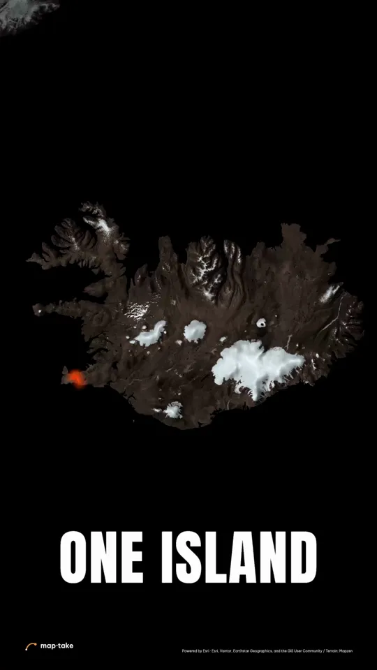
Watch how “Iceland, fire and ice” was built
How do I make a map video with AI?
Describe the video in the chat, and the agent plans it and builds it on a styled map on the timeline. The imagery is a styled or satellite map, not Google’s photoreal 3D Earth.
This is the request this example was planned from:
“Iceland in 25 seconds. Fire and ice. Make people want to book a flight tomorrow.”
It names the place, the length, two ideas and the reaction the viewer should have. That was enough for a plan with a feeling, a message and a wow moment.
The agent works in this order, the same as in the app’s chat:
- Plan. It writes the story, the feeling and the camera shots. Here: fire first, then ice, then the whole island floating on a black sea.
- Places and data. It finds the places the story needs: the Reykjanes lava fields, the Vatnajökull ice cap and the Jökulsárlón coast.
- Look. It picks one design system: black rock, white ice and one red-hot line.
- Scenes, one by one. It builds each scene on the timeline: the lava lines, the words and the camera shots.
- Review. It checks frames of the result against the plan and corrects what does not match.
- Done. You get an ordinary project. This one has 8 camera shots, 4 labels and 3 lines.
Then you edit by hand:
- Retime a camera shot or change its easing.
- Retype a word or move a line.
- Switch the base map to satellite or add 3D terrain.
This example was planned by one AI model and built by another with the editor’s own tools, not by the agent inside the app. The in-app agent works with the same tools.
How do Google Earth Studio and Maptake compare?
Checked 8 November 2026. Sources are listed at the end of the page. The cloud render page is dated 2021, so treat that row with care.
| Google Earth Studio | Maptake | |
|---|---|---|
| Plans | Free to use | A free plan, and paid plans for longer, 4K and commercial videos |
| Access | Sign in with a Google account and request access; desktop Chrome on Mac or Windows only | Sign up and open it in the browser |
| Output | A local render is an image sequence you convert to video in another app. A cloud render gives an MP4 and is experimental | MP4 or WebM |
| Imagery | Google Earth imagery in 3D | Vector map styles, Esri satellite and 3D terrain on Pro, extruded 3D buildings |
| Labels and borders | Google’s map style, switched on or off | Your own styled labels and cards, and country and region boundaries from built-in data |
| Routes and moving icons | Camera keyframes and KML overlays; the docs list no route or moving-icon tool | Routes with plane, car, train or ship icons, real roads and flight arcs |
| Audio | No audio feature in the docs | An audio track in exports on paid plans |
| Allowed use | News, film, documentaries, education and monetized online videos, with attribution. Not ads, promotional videos or real estate listings | Per plan: Pro for your own channels and business, Studio also for client work |
| Attribution | Google’s watermark on every rendered frame | Map data credits in a corner of the video, plus a line to paste into the description |
| After Effects | Exports the 3D camera as a .jsx script or JSON | After Effects pack on Pro: the map and labels as separate layers and a script that builds the comps |
When is Google Earth Studio the better choice?
- Photoreal 3D flyovers of real cities and mountains. Maptake does not have Google’s 3D imagery.
- Free use for education, documentaries and news, with Google’s attribution on screen.
- 3D camera tracking into After Effects, through its exported camera script.
When does a map editor fit better?
- Explaining something. Borders, routes, labels and numbers on a map you style yourself.
- Promotional or real estate videos, which Google’s guidelines do not allow with Earth Studio. Check the terms of your own plan and of the data you use.
- A finished MP4 with audio, without another app to assemble the frames.

Can I use both?
Yes. Render a photoreal Earth Studio shot for the opening, make the explaining map in Maptake, and cut them together in your editor. Keep Google’s attribution on the Earth Studio frames.
For the space-to-street move on a vector globe, see the globe animation guide.
Sources
Questions people ask
- Can I use Google Earth Studio for commercial videos?
- Google’s guidelines say Earth content may not be used for commercial or promotional purposes, and its FAQ says it does not offer a licence for commercial applications. News, film, documentaries and educational work are allowed with attribution, and so are online videos in those categories even when monetized. Ads, promotional videos and real estate listings are not. We are not lawyers: read Google’s geo guidelines for your case.
- Is Google Earth Studio still available?
- Yes. As of 8 November 2026 the intro page and the docs are live. The docs describe it as a preview, with access granted case by case, and we found no shutdown notice.
- Can AI make a flyover like Google Earth Studio?
- Not a photoreal one. Describe the video and the agent plans it, picks a look, places the places and routes and sets the camera shots on a styled or satellite map, with 3D terrain and extruded 3D buildings. The imagery is not Google’s photoreal 3D Earth, so for that kind of flyover Earth Studio is the better tool.
- Can I edit what the AI made?
- Yes. The agent uses the editor’s own tools, so every route, label, boundary and camera shot is a normal layer on the timeline. Retime a shot, retype a label or change the look by hand.
- Can I import KML?
- Yes. KML lines and areas import with “Feature”, then “Import a file”, in the Add dock, as do GeoJSON, GPX and TCX. KMZ is not supported yet.
- Is Maptake free?
- There is a free plan with 100 AI credits a month. It exports up to 1280 px and 10 seconds, with a watermark, for personal use. Pro removes the watermark and allows commercial use on your own channels.
Try a map video on your own place
Open the editor free, describe one scene to the agent and fine-tune it. The free plan needs no card.
Related
Map data © OpenStreetMap contributors, Natural Earth. Tiles © Protomaps. Satellite imagery: Esri.
Google Earth Studio is a trademark of Google LLC. Maptake is not affiliated with or endorsed by Google.