

Alternatives
A Travel Animator alternative in your browser, with an AI agent that drafts the trip
Travel Animator, from the developer Lascade, is a phone app for quick route videos with 3D vehicles. As a Travel Animator alternative, Maptake is a browser editor: its AI agent drafts the trip from your description and you finish it on a timeline. Choose Travel Animator for a fast reel on your phone.
Watch how “Việt Nam, one long curve” was built
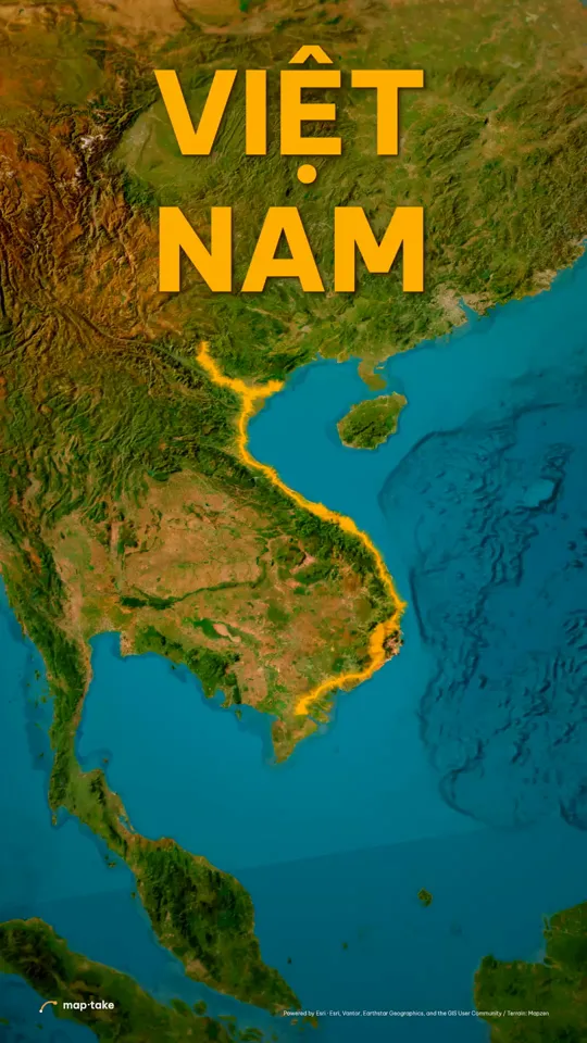
How do I make a travel map video with AI, then edit it?
Describe the trip in the chat, and the agent plans it and builds it on the timeline in the browser. Every layer it adds stays editable.
- 40 s
- vertical 9:16 travel video
- 11
- scenes, each with its own camera move
- 35
- words in the request
- 8
- labels placed on the map
This is the request this example was planned from:
“Make a 40s cinematic video about Viet Nam. I want people to fall in love with this country, from the mountains in the north to the Mekong in the south. Strong hook, energy, interesting story.”
It names the country, the length and the feeling, and the route runs from the mountains in the north to the Mekong in the south. The frame is vertical, 9:16, the size for Reels, TikTok and Shorts. The new project wizard also offers 4:5, 1:1 and 16:9, and the plan sets the largest export.
The agent works in this order, the same as in the app’s chat:
- Plan. It writes the story, the feeling and the camera shots. Here: a slow glide over each region, a fast slam to the next, one lift at the end.
- Places and data. It finds the places the story names (Ha Giang, Ha Long Bay, Hue, Hoi An, Da Lat, the Mekong) and the route between them.
- Look. It picks one design system for the whole trip. Here: warm light and one gold line.
- Scenes, one by one. It builds each scene on the timeline: the line, the labels and the camera shots.
- Review. It checks frames of the result against the plan and corrects what does not match.
- Done. You get an ordinary project. This one has 12 camera shots, 8 labels and 6 lines.
Then you edit by hand:
- Retime a camera shot or change its easing.
- Swap a stop, retype a label or add your own photos.
- Replace the route with your own GPX, KML or TCX file.
This example was planned by one AI model and built by another with the editor’s own tools, not by the agent inside the app. The in-app agent works with the same tools.
What did one request turn into, scene by scene?
The plan gave every scene a feeling and a camera speed before anything was built. The ribbon shows that speed across the video, and the frames below are the real result.
- glide
- slam
- reveal
- taller bar = faster camera
-
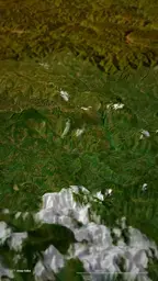 0:00 Low over the Ha Giang ridges glide · slow
-
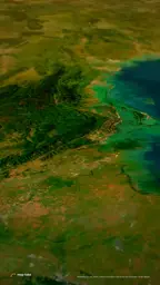 0:13 Slam to Ha Long Bay slam · very fast
-
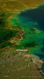 0:15 Sliding over the bay glide · slow
-
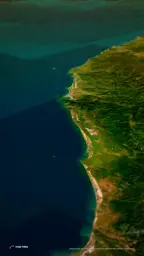 0:27 Slam to Hue slam · very fast
-
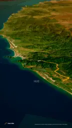 0:29 Down the central coast rush, gentle · medium
-
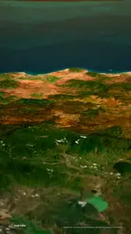 0:44 Slam to Da Lat slam · very fast
-
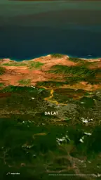 0:45 Over the highlands glide · slow
-
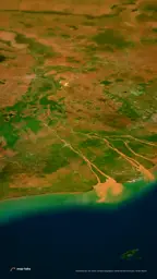 0:56 Slam to the Mekong delta slam · very fast
-
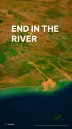 0:58 Down the river glide · slow
-
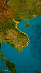 1:09 Up to the whole country reveal · fast, then very slow
-
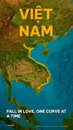 1:23 Slow turn, the title holds glide · very slow
Frames and speeds come from the example project and its camera plan. Swipe the row on a phone.
Is the result a flat video, or a project you can edit?
The MP4 is only the export. Underneath is a normal project, and the agent made it with the editor’s own tools, so every camera shot, label and line is a layer on the timeline, drawn here from the project itself.
Camera one tile per scene
Labels place names, numbers, photo credits
Routes each leg appears when the road reaches it
Because they are ordinary layers, you fix an agent’s draft the way you would fix your own, and you can export the map part and finish it in your own video editor.
Which one should you choose?
Choose by where you work and how much control you want afterwards. Travel Animator is built around the phone in your hand. Maptake is built around a computer screen and a timeline.
| Choose Travel Animator if… | Choose Maptake if… |
|---|---|
| You make your videos on your phone and want a route reel in minutes, from your stops or a GPX file. | You want an agent to plan the whole trip video from a description, with the look, the labels and the camera shots, and then keep editing it on a timeline. |
| You want a large ready-made library: 300+ 3D vehicle models and 80+ landmark models. | You want routes on real roads, flight arcs, areas and borders, and tracks imported from GPX, KML or TCX. |
| You want to paste a Google Maps directions link as the route. | You make longer videos on a computer, up to 3 minutes on Pro, and add your own audio. |
| You want a template for a recap (Travel Memories, Flight Diary, Road Trip Reel). | You want the map part as a project you can change later, or exported as a CapCut or After Effects pack for your own edit. |
How do Travel Animator and Maptake compare at a glance?
Checked 20 November 2026. Sources are listed at the end of the page.
| Travel Animator | Maptake | |
|---|---|---|
| Runs in | A phone app for iPhone and Android. Its App Store listing also lists iPad and Macs with an Apple M1 chip or later | Your browser, on a computer. There is no Maptake phone app |
| AI | Journey AI, a chat that plots a route from your description (its own article says animation is a separate step; the App Store note says it creates travel videos with AI). A local MCP server also lets an AI assistant render a video, and needs Python | An agent plans the video from your description: story, places, look and camera shots. It builds the scenes with the editor’s own tools and checks frames against the plan |
| What the AI result is | A plotted route on the map, which you then style in the app | An ordinary project, with every shot, label and line as a layer on the timeline |
| Editing by hand | Stops and curves on the map, photos, text, an avatar, a camera style and a video duration. No timeline or keyframes are mentioned on its public pages | A timeline with camera shots (11 easing curves), keyframes and a graph editor, plus labels, lines and areas as layers |
| Your own data (import) | GPX (Strava, Garmin Connect, Komoot and more named) and a pasted Google Maps directions link | GeoJSON, GPX, KML and TCX files. A pasted Google Maps link is not read |
| Moving icons and models | 300+ 3D vehicle models, 80+ landmark models, an avatar | 13 built-in line heads, your own image, Lottie or .glb model, and 3D models from a library |
| Export formats and sizes | HD and 4K video, sized for Reels, TikTok, Shorts and YouTube. File format not stated. 4K needs the premium plan | MP4 or WebM, CapCut pack (one MP4 per shot), After Effects pack on Pro. Free 1280 px and 10 seconds, Pro 3840 px (4K) and 3 minutes, Studio 3840 px (4K) and 10 minutes |
| Free plan limits | HD export with a logo, one saved route, basic models, the default map style. Its App Store notes add a free limit of 5 real route segments per export | 100 AI credits a month, 1280 px, 10 seconds, map·take watermark, no audio in exports |
| Allowed use | The terms of service we read do not mention commercial use | Free: personal, non-commercial. Pro: your own channels and business. Studio: also videos for clients |
| Map data and attribution | No map data provider is named on the pages read | Included in every plan. Map data credits are shown in the video, and the export page gives you the same credits to paste into the description |
Can I use my GPX, Strava, Garmin or Google Maps route?
Travel Animator imports a GPX file and names Strava, Garmin Connect and Komoot as sources. It also reads a pasted Google Maps directions link, which is the quickest way to turn a planned drive into a line.
Maptake imports GPX, KML and TCX as lines, and GeoJSON as lines and areas, with “Feature” and “Import a file” in the Add dock. A track you import follows the path that was recorded. It does not read a pasted Google Maps link. For stops you name yourself, ask the agent to route between them: it can follow real roads for driving, walking, cycling or motorcycling, and a rail line between stations (rail can be approximate, so check it). For a flight, a great-circle line bends over the map the way a long-haul route does.
What about the AI on each side?
Travel Animator’s Journey AI is a chat inside the app. Its own article says you describe a trip and it plots the route, and that animation is a separate step; its App Store notes say it creates travel videos with AI. It also publishes a local MCP server, for people comfortable with Python, that lets an AI assistant build and render a video. Maptake’s agent plans the story, the look and the camera, builds the scenes and checks the frames. Either way, check every stop before you export.
Which vehicles and moving icons can I use?
Travel Animator has the larger ready-made library: 300+ 3D vehicle models and 80+ landmark models. Maptake puts one of 13 built-in heads on a line (plane, helicopter, car, bus, truck, motorbike, bicycle, train, ship, boat, a walking figure, arrow or dot), or your own image, Lottie file or .glb model, and turns it along the line. A separate 3D model layer takes your .glb, a built-in 3D vehicle or a model from the library.
Phone or computer?
Maptake is built for a computer screen. It has no phone app, and a phone browser opens a compact layout of the editor. If you shoot a trip and want a reel before you leave the airport, the phone app fits better. If you want to sit down and shape the camera, the labels and the timing, Maptake fits better.
How do I move a project over?
Maptake cannot open Travel Animator projects. Bring what you have instead:
- Export your track as a GPX file from Strava, Garmin or your watch, and import it with “Feature” and “Import a file”. KML and TCX work too.
- Or describe the trip to the agent again, with the places, the length, the frame and the feeling, and edit the draft on the timeline.
- Add your photos as Image layers and time each one to the moment the line reaches the place.
The travel map animation page and the route animation guide go through each step.
Sources
- Travel Animator: home page
- Travel Animator: free and Pro limits
- Travel Animator: GPX import
- Travel Animator: how to use the app
- Travel Animator: the Journey AI route assistant
- Travel Animator: MCP server documentation
- Travel Animator: terms of service
- TravelAnimator: Journey Route on the App Store
Maptake’s own limits are on the pricing page.
Questions people ask
- Is Maptake affiliated with Travel Animator?
- No. Maptake is independent and is not affiliated with or endorsed by Travel Animator or its developer, Lascade. Many unrelated apps have similar names, so check the developer before you install one.
- Can AI make a travel route video like Travel Animator’s?
- Maptake’s agent can draft one from your description: it plans the story, finds the places, picks a look, draws the route and sets the camera shots. Travel Animator has an AI route assistant called Journey AI and a separate MCP server for AI assistants. Judge any AI draft as a draft and fix what is off by hand.
- Can I edit what the AI made?
- Yes. The agent uses the editor’s own tools, so every route, label and camera shot is a normal layer on the timeline. Retime a shot, retype a stop or replace the line with your own GPX file.
- Can I import a GPX track from Strava or Garmin?
- Yes. Export the activity as a GPX file, then choose “Feature” and “Import a file” in the Add dock. GPX, KML and TCX tracks become lines you can draw on with “Trim end” and restyle. There is no direct link to a Strava or Garmin account.
- Can I paste a Google Maps route link into Maptake?
- No. Travel Animator reads a pasted Google Maps directions link, Maptake does not. Search the places, import a GPX, KML or TCX track, or tell the agent your stops and ask it to route between them along real roads.
- Is there a free plan?
- Yes. The free plan has 100 AI credits a month and exports up to 1280 px and 10 seconds, with a watermark, for personal use. Travel Animator also has a free plan, with HD exports that carry its logo.
- Does Maptake have a phone app?
- No. Maptake runs in a browser and is built for a computer screen. A phone browser opens a compact layout of the editor, but if you mostly make your videos on a phone, Travel Animator is the better fit.
Try Maptake on your own trip
Open the editor free, describe your trip to the agent and fine-tune it. The free plan needs no card.
Related
Map data © OpenStreetMap contributors, Natural Earth. Tiles © Protomaps. Satellite imagery: Esri.
Travel Animator is a trademark of its owner, the developer Lascade. Maptake is not affiliated with or endorsed by Travel Animator or Lascade.