

Alternatives
An Animaps alternative where the AI draft is a full timeline you can edit
Looking for an Animaps alternative? Both tools turn a description into a map animation. Maptake’s AI agent leaves a layered project: camera shots, routes, labels and areas on a timeline with keyframes, plus your own GeoJSON, GPX, KML and TCX files. Choose Animaps if you want narration and captions written and voiced for you.
Watch how “How far Rome reached” was built
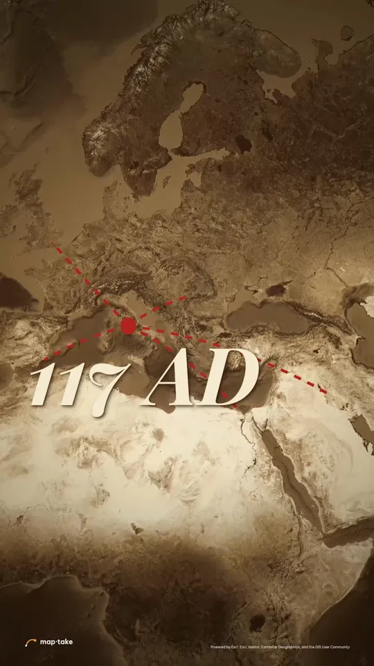
How do I make a history map video with AI, then edit it?
Describe the video in the chat, and the agent plans it and builds it on the timeline in the browser. Every layer stays editable afterwards.
- 30 s
- vertical 9:16 video
- 8
- scenes, each with its own camera move
- 13
- words in the request
- 9
- labels placed on the map
This is the request this example was planned from:
“How far did the Roman Empire actually reach? 30 seconds, epic. Hook me.”
It names the question, the length and the feeling, and nothing else. The plan decides the places, the look and the camera.
The agent works in this order, the same as in the app’s chat:
- Plan. It writes the story, the feeling and the camera shots. Here: lines march out of Rome one at a time, the map opens, then the lines retract under “it could not hold”.
- Places and data. It finds Rome and the provinces the story names (Hispania, Britannia, Dacia, Aegyptus) and the lines between them.
- Look. It picks one design system: an old relief atlas with red ink lines.
- Scenes, one by one. It builds each scene on the timeline: the lines, the place tags, the year and the camera shots.
- Review. It checks frames of the result against the plan and corrects what does not match.
- Done. You get an ordinary project. This one has 11 camera shots, 9 labels and 5 lines.
Then you edit by hand:
- Retime a camera shot and change its easing with the easing graph.
- Retype a label or reshape a line.
- Add your own audio on the timeline.
This example was planned by one AI model and built by another with the editor’s own tools, not by the agent inside the app. The in-app agent works with the same tools.
What did one request turn into, scene by scene?
The plan gave every scene a feeling and a camera speed before anything was built. The ribbon shows that speed across the video, and the frames below are the real result: slow glides carry the story, and the quick slams only get you from one place to the next.
- glide
- slam
- reveal
- taller bar = faster camera
-
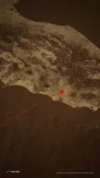 0:00 Close over central Italy glide · slow
-
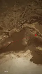 0:15 Slam out to the Mediterranean slam · very fast
-
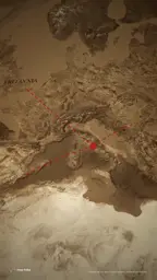 0:17 Lines march out, one by one glide · slow, steady
-
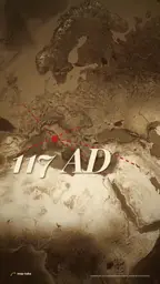 0:43 Up to the whole reach reveal · fast, then very slow
-
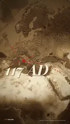 1:02 Stillness, all lines lit glide · very slow
-
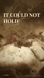 1:08 The lines draw back to Rome glide · slow
-
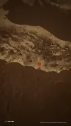 1:21 Slam back to central Italy slam · very fast
-
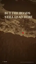 1:23 One dot on the relief glide · very slow
Frames and speeds come from the example project and its camera plan. Swipe the row on a phone.
Is the result a flat video, or a project you can edit?
With Maptake it is a project. The MP4 is only the export. Underneath, every camera shot, label and line is a layer on the timeline, drawn here from the project itself.
Camera one tile per scene
Labels place names, numbers, photo credits
Routes each leg appears when the road reaches it
Because they are ordinary layers, you fix an agent’s draft the way you would fix your own. Keyframes and an easing graph shape each move, areas can be cut by shapes to sweep an edge across them, and the same project exports as one video or as separate clips for another editor.
Animaps also keeps the AI draft editable: its pages describe a list of steps, up to 150 in one animation, each with its own location, zoom, opacity, border width, colours, bearing and tilt. The difference is the model. Animaps edits steps with start times and durations, and its guides say it has no keyframes. Maptake gives you a timeline with keyframes.
Which one should you choose?
Choose by what you want done for you and what you want to control. Animaps does more of the finishing for you. Maptake leaves more in your hands.
| Choose Animaps if… | Choose Maptake if… |
|---|---|
| You want the narration written for you and read by an AI voice, with captions that animate in (Pop, Highlight, Typewriter or Slide up). | You bring your own voiceover or music, or add the sound in your own editor. The Maptake editor has no AI voice of its own. |
| You want borders that change over time without sourcing the data: its home page lists 25,400+ historical border snapshots. | You want to control the border or front line yourself, with areas that animate, cut shapes, or a GeoJSON file of the period. |
| You want longer clips on the free plan (up to 30 seconds for each animation), or a GIF of 6 seconds or less. | You want your own routes and shapes on the map, from GeoJSON, GPX, KML or TCX files, or a table of numbers that colours regions. |
| You want to type short instructions and have a preview in about a minute or two, with every step listed. | You want to retime shots with keyframes and an easing graph, or to hand the map to your own video editor. |
| You make short clips for Shorts, lessons or presentations: its Pro plan runs animations up to 60 seconds, in 4K if you want it. | You need a longer video: Pro exports up to 3 minutes and Studio up to 10 minutes. |
How do Animaps and Maptake compare at a glance?
Checked 20 November 2026. Sources are listed at the end of the page.
| Animaps | Maptake | |
|---|---|---|
| Runs in | Your browser. Rendering runs in the cloud | Your browser. The video renders in the browser |
| AI | Describe it; the AI builds a draft of steps and can write the narration | Describe it; the agent plans the story, picks a look, places the places, borders and routes and sets the camera shots |
| What the AI result is | A list of editable steps, up to 150 in one animation | An ordinary project: camera shots, routes, labels and areas as layers on a timeline |
| Editing by hand | Per step: location, zoom, opacity, border width, colours, bearing and tilt. Start times and durations on a timeline. Its guides say it has no keyframes | Keyframes, an easing graph for each keyframe, camera shots, cut shapes for areas |
| Your own data (import) | None mentioned on its public pages. Its home page says you never import a shapefile or trace a border by hand | GeoJSON, GPX, KML and TCX as lines and areas; CSV or TSV tables up to 3 MB; images, Lottie, .glb models and audio. Not KMZ or shapefiles |
| Narration and captions | AI voice with a choice of voice, tone and pace, many languages, captions in four styles. Or upload your own recording | Record or add your own audio on the timeline; a Caption card for one highlighted sentence. No AI voice in the editor and no word-by-word captions |
| Export formats and sizes | MP4 and GIF (GIF up to 6 s); 16:9, 9:16, 1:1, 4:5; 720p to 1440p, and 4K up to 60 s on Pro; 30 or 60 fps | MP4 or WebM; 16:9, 9:16, 1:1, 4:5; CapCut pack (one MP4 per shot); After Effects pack on Pro |
| Longest video | Per animation: 30 s on Free, 45 s on Starter, 60 s on Pro | Free 10 seconds, Pro 3 minutes, Studio 10 minutes |
| Free plan limits | 12 credits a month, 3 AI prompts a month, up to 30 s per animation, 1080p, watermark | 100 AI credits a month, 1280 px, 10 seconds, watermark, no audio in exports, non-commercial |
| Allowed use | Its terms license exported videos for your own productions, commercial and monetized use and work for paying clients included, for exports from 17 November 2026. No reselling the footage as stock | Free: personal, non-commercial. Pro: your own channels and business. Studio: also videos for clients |
| Map data and attribution | A small map-data credit on every export, on every plan, that cannot be removed. Satellite styles use third-party imagery | Map data credits shown in the video, plus a line to paste into your description. Satellite and 3D terrain in exports on Pro |
| Historical borders | Built in: 25,400+ dated snapshots (its pages say borders before modern surveying are approximate) | Built-in borders are today’s. For another period, import a GeoJSON file of that period |
Can I bring my own data?
In Maptake, yes. Choose “Feature”, then “Import a file”, in the Add dock. GeoJSON, GPX, KML and TCX files become lines and areas on the map, and you can also add images, Lottie files, .glb models and audio. A CSV or TSV table of up to 3 MB can be joined to boundaries, so a column of numbers sets how each region is coloured. KMZ and shapefiles are not supported yet.
Animaps’ public pages describe a different route: you type a place name and it finds the outline, and its home page says you never need to import a shapefile or trace a border by hand. Its features page lists photo pins and its own Atlas data overlays, and none of its pages mention importing your own dataset. That is simpler when the place is in its catalogue, and a limit when your data is not.
What about narration and captions?
Animaps is stronger here. You write narration as sentences that appear as captions, and an AI voice reads them, with a choice of voice, tone and pace, in many languages. You can also upload your own recording.
In Maptake you add your own audio. The Add dock has “Add audio”, where you choose a file (MP3, WAV, M4A or OGG) or record from your microphone, and the clip sits on the timeline at the playhead. Audio in exports is on Pro and Studio (No on Free). Text goes on the map as labels and cards, including a Caption card with one sentence and the key words highlighted. The editor has no AI voice of its own and no word-by-word captions, so if you want those written and voiced for you, Animaps is the better choice.
How do I show a territory changing over time?
Rome is a territory story, and both tools can tell it. Animaps lists built-in historical border snapshots, 25,400+ on its home page, and its history page advises you to treat the result as an illustration and to check dates and extents against your own references.
Maptake works from your sources. Its built-in borders are today’s, so for a period map you import a GeoJSON file of that period. Areas animate (trim, opacity, size), and cut shapes, a line, circle or polygon that you keyframe, sweep a hard, jagged or soft edge across an area, which is how you draw a front line moving. The Rome example above draws Rome’s reach as lines between places, not as filled territory, so it shows the story rather than a historical border dataset.
How do I move a project over?
Maptake cannot open Animaps projects, and Animaps’ public pages describe no export of project data. Start again with what you already have:
- Bring your routes and shapes as GeoJSON, GPX, KML or TCX files, and tables as CSV, with “Feature”, then “Import a file”.
- Or describe the video to the agent again, with the same places, script and length, and edit the draft on the timeline.
- Add your audio on the timeline, and set the frame (9:16, 4:5, 1:1 or 16:9) when you create the project.
The Rome example above is a finished project made with Maptake, and the war and history guide shows the parts of a history map.
Sources
- Animaps: home page
- Animaps: features
- Animaps: plans (limits only)
- Animaps: terms of service
- Animaps: help center
- Animaps: history map animation
- Animaps: guide to the manual map editor
- Animaps: guide to AI map prompts
Maptake plan limits: pricing and plan limits. Animaps pages read on 20 November 2026.
Questions people ask
- Is Maptake affiliated with Animaps?
- No. Maptake is independent and is not affiliated with or endorsed by Animaps. We compare the two tools from what Animaps publishes on its own pages, read on 20 November 2026.
- Can AI make a history map video like an Animaps one?
- Maptake’s agent can build a first draft from a description: it plans the story, picks a look, places the places and routes and sets the camera shots. Animaps does this too, and it also writes and voices the narration. Treat any AI draft as a draft and check names, dates and borders against your sources.
- Can I edit what the AI made?
- Yes. The agent uses the editor’s own tools, so every route, label, area and camera shot is a normal layer on the timeline. Retime a shot, change its easing, retype a label or add your own audio, the same way you would in a project you built yourself.
- Is there a free plan?
- Yes. Maptake’s free plan has 100 AI credits a month and exports up to 1280 px and 10 seconds, with a watermark, for personal use. Animaps also has a free plan: 12 credits a month, up to 30 seconds per animation and a watermark.
- Can I import my own GPX or GeoJSON file?
- Yes. In Maptake, choose “Feature”, then “Import a file”, in the Add dock. GeoJSON, GPX, KML and TCX import as lines and areas. Animaps’ public pages mention no import of your own data.
- Can Maptake add narration and captions?
- Not inside the editor. You record or add your own audio on the timeline, and text goes on the map as labels and cards, including a Caption card for one highlighted sentence. Animaps writes the narration, reads it with an AI voice and shows animated captions, so it is the better choice if you want that done for you.
- Can I show historical borders in Maptake?
- Maptake’s built-in country and region data is today’s borders. For another period, import a GeoJSON file of that period from a historical source and animate it with areas and cut shapes. Animaps lists built-in historical border snapshots, which saves that step.
Try Maptake on your own map story
Open the editor free, describe one scene to the agent and fine-tune it. The free plan needs no card.
Related
Map data © OpenStreetMap contributors, Natural Earth. Tiles © Protomaps. Satellite imagery: Esri.
Animaps is a trademark of its owner. Maptake is not affiliated with or endorsed by Animaps.